Near Wellston in Jackson County, Ohio — The American Midwest (Great Lakes)
Berlin Heights Battlefield
July 17, 1863
| — | Berlin X-Roads Jackson County, Ohio | — |
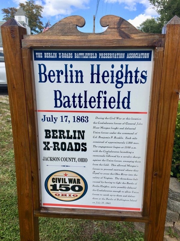
Photographed by Mark Hilton, September 9, 2017
1. Berlin Heights Battlefield Marker
Erected 2015 by The Berlin X-Roads Battlefield Preservation Association.
Topics. This historical marker is listed in these topic lists: Notable Events • War, US Civil. A significant historical date for this entry is July 19, 1863.
Location. 39° 4.849′ N, 82° 32.293′ W. Marker is near Wellston, Ohio, in Jackson County. It is on Ohio Route 327 north of Route 124, on the right when traveling
this page online

Regionally, this marker is in Southern Ohio Hill Country. It is also in the American Midwest, in Appalachia, and specifically in Northern Appalachia. Globally, it is in North America, the Western Hemisphere, the Western World, and the Anglosphere. Historically, it finds itself in what was once the Haudenosaunee (Iroquois) Confederacy, the territory of the Mississippian Culture, and the Northwest Territory.
Other nearby markers. At least 8 other markers are within 5 miles of this marker, measured as the crow flies: Berlin Crossroads (here, next to this marker); Crossroads To Freedom (here, next to this marker); In Memory of the Unknown Confederate Soldiers (approx. 1.9 miles away); Civil War (approx. 4.6 miles away); a different marker also named Hanging Rock Region (approx. 4.6 miles away); Buckeye Furnace (1851 - 1894) (approx. 4.6 miles away); Buckeye Furnace Covered Bridge (approx. 4.6 miles away); Casting (approx. 4.7 miles away).
Other markers no longer nearby. Hanging Rock Region
Photographed by Mark Hilton, September 9, 2017
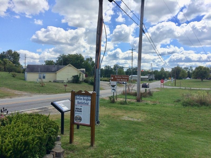
2. Berlin Heights Battlefield Marker next to Berlin Crossroads marker.
Also see . . . The Battle of Berlin Heights 1863, Berlin Cross Roads, Jackson County, Ohio (YouTube video). (Submitted on September 13, 2017, by Mark Hilton of Montgomery, Alabama.)
Credits. This page was last revised on November 12, 2024. It was originally submitted on September 13, 2017, by Mark Hilton of Montgomery, Alabama. This page has been viewed 2,675 times since then and 116 times this year. Photos: 1, 2. submitted on September 13, 2017, by Mark Hilton of Montgomery, Alabama.
