Hendersonville in Henderson County, North Carolina — The American South (South Atlantic)
Howard Gap Road
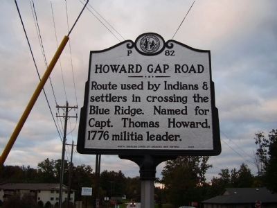
Photographed by Stanley and Terrie Howard, October 11, 2008
1. Howard Gap Road Marker
Erected 2007 by North Carolina Office Of Archives and History. (Marker Number P-82.)
Topics and series. This historical marker is listed in these topic lists: Indigenous Peoples and Communities • Roads & Vehicles • War, US Revolutionary. In addition, it is included in the North Carolina Division of Archives and History series list. A significant historical year for this entry is 1776.
Location. 35° 20.985′ N, 82° 25.95′ W. Marker is in Hendersonville, North Carolina, in Henderson County. It is at the intersection of Howard Gap Rd. (U.S. 64) and Chimney Rock Rd. (North Carolina Highway 1006) on Howard Gap Rd.. Touch for map. Marker is in this post office area: Hendersonville NC 28792, United States of America. Touch for directions.

Regionally, this marker is in the Mountains and in Greater Asheville. It is also in the American South, specifically in the Upper South, in Appalachia, and specifically in Southern Appalachia. Globally, it is in North America, the Western Hemisphere, the Western
this page online
Other nearby markers. At least 8 other markers are within 3 miles of this marker, measured as the crow flies: Stoneman's Raid (approx. 0.4 miles away); Seventh Avenue Depot Historic District (approx. 2.4 miles away); Hendersonville High School (approx. 2.6 miles away); 1 Bearcat Boulevard (approx. 2.7 miles away); Syndicate Building (approx. 2.7 miles away); Clarke Hardware Building (approx. 2.7 miles away); Kirk Building (approx. 2.7 miles away); Hunter Building (approx. 2.7 miles away). Touch for a list and map of all markers in Hendersonville.
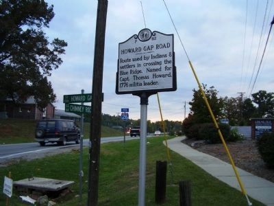
Photographed by Stanley and Terrie Howard, October 11, 2008
2. Howard Gap Road Marker
Credits. This page was last revised on June 21, 2021. It was originally submitted on October 11, 2008, by Stanley and Terrie Howard of Greer, South Carolina. This page has been viewed 3,114 times since then and 45 times this year. Photos: 1, 2. submitted on October 11, 2008, by Stanley and Terrie Howard of Greer, South Carolina. • Bill Pfingsten was the editor who published this page.
