Tepotzotlán, Mexico State, Mexico — The Central Highlands (North America)
Atrium of the Olives
Inscription.
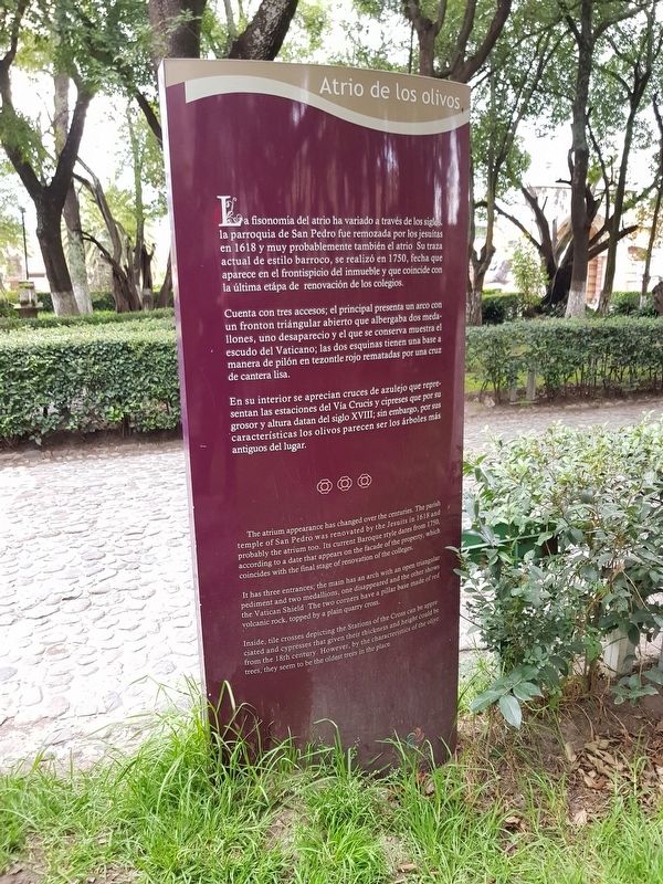
Atrio de los olivos
La fisonomía del atrio ha variado a través de los siglos, la parroquia de San Pedro fue remozada por los jesuitas en 1618 y muy probablemente también el atrio. Su traza actual de estilo barroco, se realizó en 1750, fecha que aparece en el frontispicio del inmueble y que coincide con la última etápa de renovación de los colegios.
Cuenta con tres accesos; el principal presenta un arco con un fronton triángular abierto que albergaba dos medallones, uno desaparecio y el que se conserva muestra el escudo del Vaticano; las dos esquinas tienen una base a manera de pilón en tezontle rojo rematadas por una cruz de cantera lisa.
En su interior se aprecian cruces de azulejo que representan las estaciones del Vía Crucis y cipreses que por su grosor y altura datan del siglo XVIII; sin embargo, por sus características los olivos parecen ser los árboles más antiguos del lugar.
The Atrium of the Olives
The atrium appearance has changed over the centuries. The parish temple of San Pedro was renovated by the Jesuits in 1618 and probably the atrium too. Its current Baroque style dates from 1750, according to a date that appears on the façade of the property, which coincides with the final stage of renovation of the colleges.
It has three entrances, the main has an arch with an open triangular pediment and two medallions, one disappeared and the other shows the Vatican Shield. The two corners have a pillar base made of red volcanic rock, topped by a plain quarry cross.
Inside, tile crosses depicting the Stations of the Cross can be appreciated and cypresses that given their thickness and height could be from the 18th century. However, by the characteristics of the olive trees, they seem to be the oldest trees in the place.
Topics. This historical marker is listed in these topic lists: Churches & Religion • Colonial Era • Man-Made Features • Parks & Recreational Areas. A significant historical year for this entry is 1618.
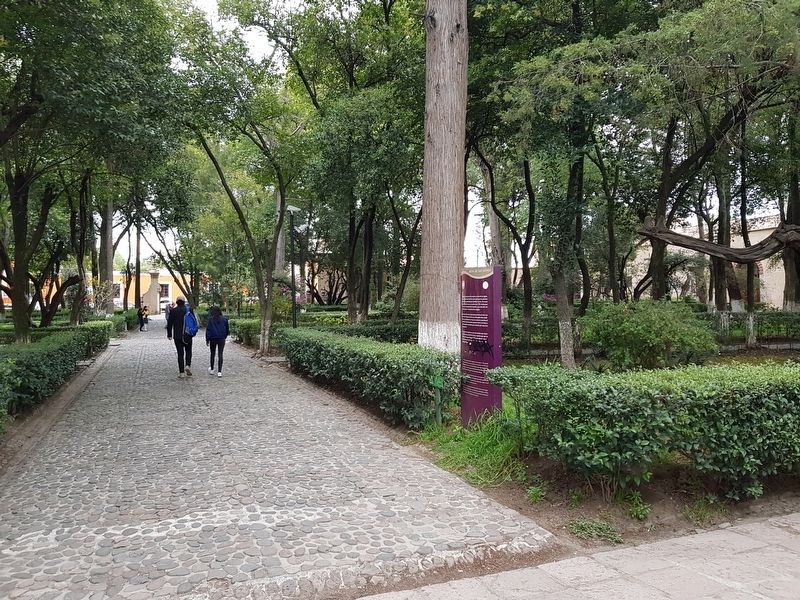
Location. 19° 42.816′ N, 99° 13.342′ W. Marker is in Tepotzotlán, Estado de Mexico (Mexico State). Marker can be reached from General Ignacio Zaragoza just north of Virreynal, on the right when traveling north. The marker is near the southern entrance of the atrium garden, on the right after entering the garden. Touch for map. Marker is in this post office area: Tepotzotlán MEX 54600, Mexico. Touch for directions.
Other nearby markers. At least 8 other markers are within 14 kilometers of this marker, measured as the crow flies. Camino Real de Tierra Adentro (within shouting distance of this marker);
Old Jesuit School of San Martín (within shouting distance of this marker); Principal Facade of the San Francisco Javier Church (within shouting distance of this marker); 17th Century Entryway (within shouting distance of this marker); The Cloister of San Francisco Javier (about 90 meters away, measured in a direct line); The Royal Inland Road at Tepotzotlán (about 90 meters away); The Aqueduct of Xalpa (approx. 14 kilometers away); Sierra of Tepotzotlán (approx. 14.1 kilometers away). Touch for a list and map of all markers in Tepotzotlán.
More about this marker. The marker face has been vandalized and painted.
Credits. This page was last revised on November 3, 2018. It was originally submitted on November 3, 2018, by J. Makali Bruton of Accra, Ghana. This page has been viewed 91 times since then and 5 times this year. Photos: 1, 2. submitted on November 3, 2018, by J. Makali Bruton of Accra, Ghana.

