Quetzaltenango, Guatemala — Central America
Foundation of the Quetzaltenango Cemetery
Inscription.
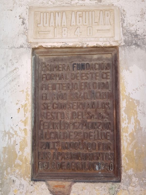
Primera fundación formal de este cementerio erigida el año 1840. Aquí se conservan los restos del Sr. Dn. Felix López Monzón, Alcalde 2º de Quezalto, inmolado por los apasionamientos del 2 de abril de 1840.
Juana Aguilar – 1840 -
First formal foundation of this cemetery erected in 1840. Here rest the remains of Félix López Monzón, 2nd Mayor of Quetzaltenango, immolated by the passions of April 2, 1840.
Juana Aguilar - 1840 -
Topics. This memorial is listed in these topic lists: Cemeteries & Burial Sites • Man-Made Features • Wars, Non-US. A significant historical date for this entry is April 2, 1840.
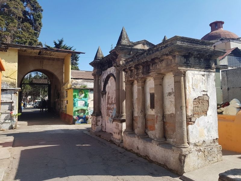
Location. 14° 50.196′ N, 91° 31.581′ W. Marker is in Quetzaltenango. Memorial is at the intersection of 20 Avenida and 8a Calle, on the left when traveling north on 20 Avenida. The marker is just inside and to the left after entering the Quetzaltenango General Cemetery. Touch for map. Marker is in this post office area: Quetzaltenango 09001, Guatemala. Touch for directions.
Other nearby markers. At least 8 other markers are within walking distance of this marker. 100th Anniversary of the Marimba Ideal (within shouting distance of this marker); 100th Anniversary of the Birth of the Poet Osmundo Arriola (about 90 meters away, measured in a direct line); Justo Rufino Barrios (about 150 meters away); The Soldiers Monument of Quetzaltenango (about 210 meters away); Dr. Rodolfo Robles (approx. half a kilometer away); Los Altos Electric Railway (approx. half a kilometer away); Mother María Encarnación Rosal (approx. half a kilometer away); World Record for a Marathon While Jumping Rope (approx. half a kilometer away). Touch for a list and map of all markers in Quetzaltenango.
Regarding Foundation of the Quetzaltenango Cemetery. The 'passions of April 2, 1840' refer to the warfare surrounding the attempts of what is now the department of Quetzaltenango to break away from the rest of Guatemala and form its own country. The Guatemalan president and dictator Rafael Carrera sent his army to the self-proclaimed 'Sixth State of the Highlands' (Sexto Estado de los Altos) to put down the rebellion. Many of the revolutionaries that had attempted to form a new government, including the Mayor Félix López Monzón, were shot by firing squad near what is now Quetzaltenango's central park.
Credits. This page was last revised on January 17, 2019. It was originally submitted on January 17, 2019, by J. Makali Bruton of Accra, Ghana. This page has been viewed 125 times since then and 9 times this year. Photos: 1, 2. submitted on January 17, 2019, by J. Makali Bruton of Accra, Ghana.

