Bacalar, Quintana Roo, Mexico — The Yucatan Peninsula (The Southeast)
Bacalar
Pueblo Mágico
Pueblo Mágico
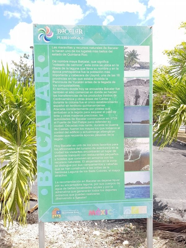
Las maravillas y recursos naturales de Bacalar lo hacen uno de los lugares más bellos del estado de Quintana Roo.
De nombre maya Bakjalal, que significa "rodeado de carrizos", esta zona se ubica en la ribera de la laguna que lleva su nombre y en la época prehispánica fue la población más importante y cabecera de Uaymil, una de las 16 provincias en las que estaba dividida la Península de Yucatán antes de la llegada de los conquistadores.
El territorio donde hoy se encuentra Bacalar fue también el sitio comercial en donde se hacían las transferencias de los productos traídos de Centroamérica y otras áreas del Caribe y durante la colonia fue el único establecimiento español en territorio quintanarroense. Atacada constantemente por piratas que arribaban a la región para saquear el palo de tinte y otras maderas preciosas, las autoridades de Bacalar construyeron en 1729 eI Fuerte de San Felipe para defender su ciudad. Décadas más tarde, durante la Guerra de Castas, fueron los mayas los que tomaron el control del edificio y actualmente alberga un museo que recuerda épocas pasadas de la región.
Hoy Bacalar es uno de los sitios favoritos para los aficionados del turismo de aventura y en la ciudad los visitantes encontrarán un lugar de ambiente tranquilo con restaurantes pequeños y hoteles que conviven en armonía con los recursos naturales. El alojamiento en la zona se distingue por sus campamentos y cabañas que se han construido a las orillas de la hermosa Laguna de los Siete Colores, el mayor atractivo.
La recomendación en Bacalar es dejarse llevar por su encantadora laguna, por sus cuerpos de agua de bellas tonalidades azules y por la adrenalina que generarán todos los deporte extremos que pueden realizarse.
¡Bienvenido a Bacalar!
Bacalar
The wonders and natural resources of Bacalar make it one of the most beautiful places in the state of Quintana Roo.
Its original Mayan name was Bakjalal, which means "surrounded by reeds", so its natural this area is located on the banks of the lagoon that bears its name and in pre-Hispanic times was the most important town and capital of Uaymil, one of the 16 provinces in which the Yucatan Peninsula was divided before the arrival of the Spanish conquerors.
The territory where today Bacalar is located was also the commercial site where products brought from Central America and other areas of the Caribbean were exchanged and
during the colonial period it was the only Spanish establishment in the territory of Quintana Roo. It was constantly attacked by pirates who arrived to the region to steal dye wood and other precious woods. The Bacalar authorities built in 1729 the Fort of San Felipe to defend their city. Decades later, during the Caste War, it was the Mayans who took control of the building and it now houses a museum that recalls the region’s past.
Today Bacalar is one of the favorite places for fans of adventure tourism and in the city visitors will find a place with a quiet atmosphere with small restaurants and hotels that live in harmony with its natural resources. The accommodations in the area are distinguished by its camps and cabins that have been built on the shores of the beautiful Lake of Seven Colores, the biggest attraction.
Our recommendation in Bacalar is to let yourself be carried away by its enchanting lagoon, by its beautiful blue toned bodies of water and by the adrenaline generated by all the extreme sports that can be done here.
Welcome to Bacalar!
Topics. This historical marker is listed in these topic lists: Colonial Era • Environment • Settlements & Settlers • Wars, US Indian. A significant historical year for this entry is 1729.
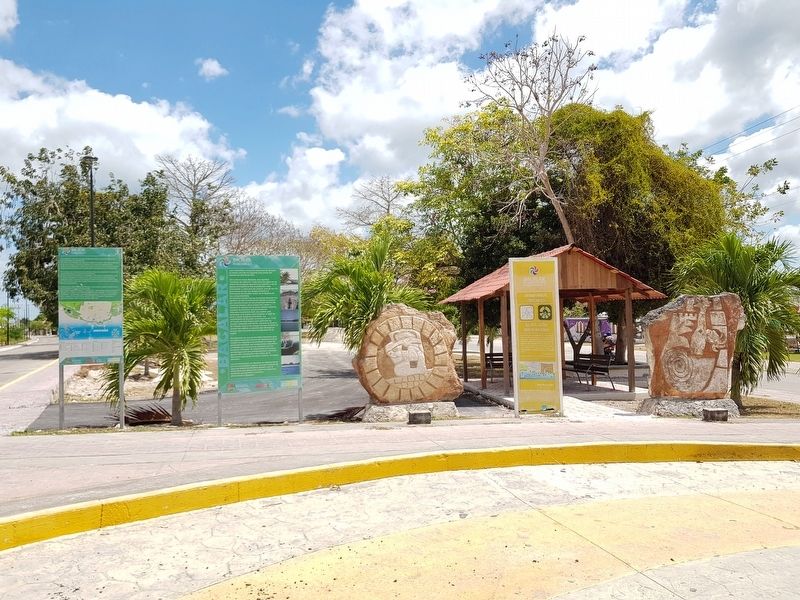
Location. 18° 40.351′ N, 88° 23.632′ W. Marker is in Bacalar , Quintana Roo. Marker is at the intersection of Adolfo López Mateos and Calle 10, in the median on Adolfo López Mateos. Touch for map. Marker is in this post office area: Bacalar QR 77930, Mexico. Touch for directions.
Other nearby markers. At least 8 other markers are within walking distance of this marker. A different marker also named Bacalar (here, next to this marker); Bel Itzá, or Path of the Itzaes (here, next to this marker); Pre-Columbian Time, End of Period (about 150 meters away, measured in a direct line); Bacalar - 1729 (about 240 meters away); Cenotes, Fresh Water Supply (approx. 0.3 kilometers away); a different marker also named Bacalar (approx. half a kilometer away); Bacalar in the XVI Century (approx. half a kilometer away); K'atunes or Periods of History (approx. half a kilometer away). Touch for a list and map of all markers in Bacalar.
Credits. This page was last revised on June 17, 2019. It was originally submitted on June 17, 2019, by J. Makali Bruton of Accra, Ghana. This page has been viewed 132 times since then and 7 times this year. Photos: 1, 2. submitted on June 17, 2019, by J. Makali Bruton of Accra, Ghana.

