Calderitas in Othón P. Blanco, Quintana Roo, Mexico — The Yucatan Peninsula (The Southeast)
An Altar at Oxtankah
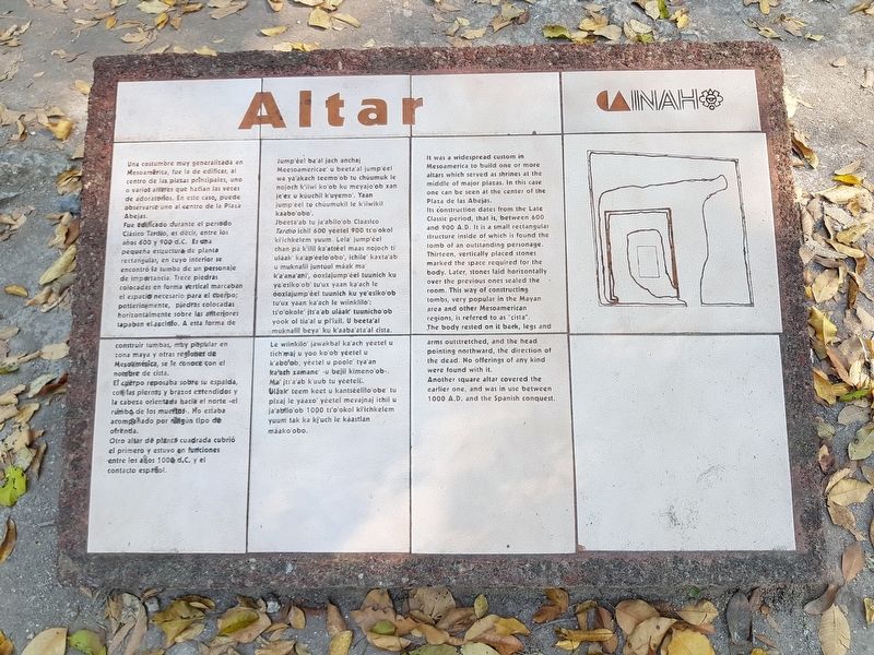
Una costumbre muy generalizada en Mesoamérica, fue la de edificar, al centro de las plazas principales, uno o varios altares que hacían las veces de adoratorios. En este caso, puede observarse uno al centro de la Plaza Abejas.
Fue edificado durante el periodo Clásico Tardío, es decir, entre los años 600 y 900 d.C. Es una pequeña estructura de planta rectangular, en cuyo interior se encontró la tumba de un personaje de importancia. Trece piedras colocadas en forma vertical marcaban el espacio necesario para el cuerpo; posteriomente, piedras colocadas horizontalmente sobre las anteriores tapaban el recinto. A esta forma de construir tumbas, muy popular en zona maya y otras regiones de Mesoamérica, se le conoce con el nombre de cista.
El cuerpo reposaba sobre su espalda, con las piernas y brazos extendidos y la cabeza orientada hacia el norte – el rumbo de los muertos. No estaba acompañado por ningún tipo de ofrenda.
Otro altar de planta cuadrada cubrió el primero y estuvo en funciones entre los años 1000 d.C. y el contacto español.
Altar
Jump'éel baal jach anchaj Meesoamericae' u beeta'al jump'éel wa ya'akach teemo'ob tu chúumuk le nojoch k'iwi ko'ob ku meyajo'ob xan je'ex u kúuchil k'uyemo'. Yaan jump'éel tu chúumukil le k'iiwikil kaabo'obo'.
Jbeeta’ab tu ja'abilo'ob Claasico Tardío ichil 600 yéetel 900 ts'o'okol ki'ichkelem yuum. Lela' jump'éel chan pa k'ilil ka'atséel maas nojoch ti uláak' ka ap'éelo'obo', ichile kaxta ab u muknalil juntúul máak ma k'a'ana ani, óoxlajump'éel tuunich ku ye'esiko'ob tu'ux yaan kaach le óoxlajumpéel tuunich ku ye'esiko'ob tu'ux yaan ka'ach le wiinklilo': ts'o'okole' jts'a'ab uláak tuunicho’ob yóok ol tia'al u pi'ixil. U beeta'al muknalil beva' ku k'aaba ata'al cista.
Le wiinkilo' jawakbal ka ach yéetel u tich'maj u yoo ko'ob yéetel u k'aboob, yéetel u poole tya'an kalach xamane - u bejil kimeno'ob -. Ma its'a ab k'uub tu yéeteli’. Uláak teem keet u kantséelilo obe' tu pixaj le yáaxo yéetel mevajnaj ichil u ja abilo'ob 1000 ts'o'okol ki'ichkelem yuum tak ka kj'uch le káastlan máako'obo.
Altar
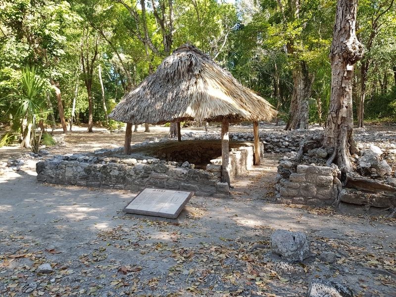
It was a widespread custom in Mesoamerica to build one or more altars which served as shrines at the middle of major plazas. In this case one can be seen at the center of the Plaza de las Abejas.
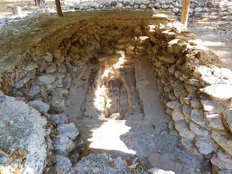
Its construction dates from the Late Classic period, that is, between 600 and 900 A.D. It is a small rectangular structure inside of which is found the tomb of an outstanding personage. Thirteen, vertically placed stones marked the space required for the body. Later, stones laid horizontally over the previous ones sealed the room. This way of constructing tombs, very popular in the Mayan area and other Mesoamerican regions, is refered to as "cista".
The body rested on it back, legs and arms outstretched, and the head pointing northward, the direction of the dead. No offerings of any kind were found with it.
Another square altar covered the earlier one, and was in use between 1000 A.D. and the Spanish conquest.
Erected by Instituto Nacional de Antropología e Historia (INAH).
Topics. This historical marker is listed in these topic lists: Anthropology & Archaeology • Cemeteries & Burial Sites • Churches & Religion • Native Americans.
Location. 18° 36.417′ N, 88° 14.133′ W. Marker is in Calderitas, Quintana Roo, in Othón P. Blanco. Marker can be reached from Unnamed road just west of Chetumal Coastal Road, on the left when traveling north. The marker is at the Oxtankah Archaeological Site. Touch for map. Marker is in this post office area: Calderitas QR 77960, Mexico. Touch for directions.
Other nearby markers. At least 8 other markers are within 14 kilometers of this marker, measured as the crow flies. Structure III at Oxtankah - Palace (within shouting distance of this marker); Structure IV at Oxtankah
(within shouting distance of this marker); Structure IX at Oxtankah - Palace (about 180 meters away, measured in a direct line); Oxtankah Archaeological Site (approx. 0.4 kilometers away); Chetumal - Kohunlich and Oxtankah (approx. 10.5 kilometers away); Heroes of April 1914 (approx. 11.5 kilometers away); Chetumal Meetings (approx. 12.2 kilometers away); The Chetumal Mask (approx. 13.1 kilometers away). Touch for a list and map of all markers in Calderitas.
Credits. This page was last revised on June 25, 2019. It was originally submitted on June 25, 2019, by J. Makali Bruton of Accra, Ghana. This page has been viewed 86 times since then and 3 times this year. Photos: 1, 2, 3. submitted on June 25, 2019, by J. Makali Bruton of Accra, Ghana.


