San Miguel de Allende, Guanajuato, Mexico — The Central Highlands (North America)
Benito Juárez Park
San Miguel de Allende - El Corazón de México
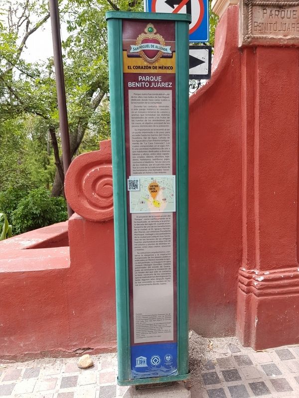
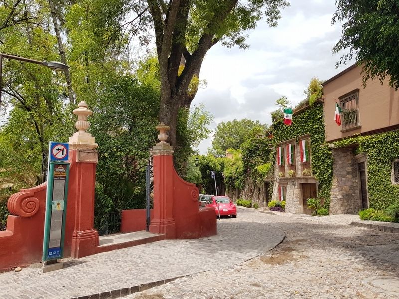
Parque Juárez fue construido en uno de los sitios más bellos de San Miguel, dedicado desde hace varios lustros a la recreación de la comunidad.
Durante las centurias virreinales, a este paraje histórico le caracterizó un mosaico inmerso de colores y aromas que brindaban las distintas tonalidades de verde y los frutos de las huertas de los alrededores; por tal causa, el objetivo principal de los paseos dominicales de la población.
Su importancia se acrecentó al ser un punto intermedio o de paso, para acceder hasta los barrios del Chorro, Guadiana, Ojo de Agua, Cañada de los Aguacates y San Antonio (antiguamente de "La Casa Colorada"). Los cuales comprendían en el siglo XVI-II, una vecindad multiétnica de 100 a 500 habitantes dedicados a diversas labores y oficios, entre ellos zapateros, criados, silleros, albañiles, tejedores, hortelanos, ladrilleros, pajes, cocheros e hiladores. Tal vez sea uno de los motivos, por el cual esta zona fue la cuna de la tradicional fiesta de los hortelanos y los llamados “locos”, realizada en honor a San Antonio.
El proyecto de la construcción del “Parque”, como cariñosamente se le ha bautizado, se remonta a la primera década del siglo XX, cuando el entusiasmo de uno de los benefactores de la ciudad, el Dr. Ignacio Hernández Macías, por entonces Presidente Municipal, contagió a los pobladores de la ciudad para adquirir tres hectáreas en los terrenos de las antiguas huertas, plantándose en ellas más de mil áboles y plantas de distintas especies, entres ellas cedros, azucenas y violetas.
Su estructura arquitectónica, conserva la elegancia y la inspiración europeizada de los paseos públicos edificados en México durante la época del porfiriato. Le inauguró en 1904 Joaquón Obregón González, notable gobernador del estado de Guanajuato, al concluirse la instalación un kiosko del que sólo se conserva la base, escenario de los conciertos que se realizaban los domingos por la tarde. Algunos años después (1916), le fue concedido su nombre en honor al benemérito Benito Juárez.
Benito Juárez Park
Juárez Park was built in one of the most beautiful sites in San Miguel, dedicated for several decades to the recreation of the community.
During the centuries of the viceroyalty, this historical site was characterized by an immersive mosaic of colors and aromas that was represented by the different shades of green and the fruits of the surrounding gardens. It
was well known as a place for Sunday walks.
Its importance was increased by being an intermediate or passing point in order to access the neighborhoods of Chorro, Guadiana, Ojo de Agua, Cañada de los Aguacates and San Antonio (formerly "La Casa Colorada" or “The Red House”). During the 16th and 17th centuries, this was a multi-ethnic neighborhood of 100 to 500 inhabitants dedicated to various trades and professions, including shoemakers, servants, chairmakers, masons, weavers, gardeners, brick makers, pages, coachmen and spinners. Perhaps this explains one of the reasons why this area was the cradle of the traditional festival of gardeners and the so-called "crazy time", held in honor of San Antonio.
The “Park” construction project, as it has been affectionately baptized, dates back to the first decade of the 20th century. One of the city's benefactors, Dr. Ignacio Hernández Macías, then Municipal President, contacted the inhabitants of the city to acquire three hectares in the lands of the old orchards. More than a thousand trees and plants of different species were used to beautify the park, including cedars, lilies and violets.
Its architectural structure preserves the elegance and Europeanized inspiration of public walks built in Mexico during the Porfirian era. It was inaugurated in 1904 by Joaquón Obregón González, notable governor of the state of Guanajuato. The inauguration took place at a kiosk of which only the base is conserved, scene of the concerts that take place on Sunday afternoons. A few years later (1916), the park was named in honor of the meritorious Benito Juárez.
Erected by El Honorable Ayuntamiento de San Miguel de Allende y UNESCO.
Topics. This historical marker is listed in these topic lists: Charity & Public Work • Colonial Era • Hispanic Americans • Parks & Recreational Areas. A significant historical year for this entry is 1904.
Location. 20° 54.511′ N, 100° 44.508′ W. Marker is in San Miguel de Allende, Guanajuato. Marker is at the intersection of Baeza and Diezmo Viejo, on the left when traveling north on Baeza. Touch for map. Marker is in this post office area: San Miguel de Allende GTO 37700, Mexico. Touch for directions.
Other nearby markers. At least 8 other markers are within walking distance of this marker. José Mojica (about 90 meters away, measured in a direct line); The Fountain (El Chorro) (about 120 meters away); El Chorro Neighborhood (about 120 meters away); Izquinapan and the Founding of San Miguel de Allende (about 120 meters away); Pedro Vargas (approx. 0.3 kilometers away); Tomás Delgado Diosdado (approx. 0.4 kilometers away); Juan José Martínez (approx. 0.4 kilometers away); Luis Pérez Lara (approx. half a kilometer away). Touch for a list and map of all markers in San Miguel de Allende.
Credits. This page was last revised on January 4, 2023. It was originally submitted on October 10, 2019, by J. Makali Bruton of Accra, Ghana. This page has been viewed 265 times since then and 49 times this year. Photos: 1, 2, 3. submitted on October 10, 2019, by J. Makali Bruton of Accra, Ghana.


