Grangeville in Idaho County, Idaho — The American West (Mountains)
The Camas Connection

Photographed By Barry Swackhamer, August 25, 2019
1. The Camas Connection Marker
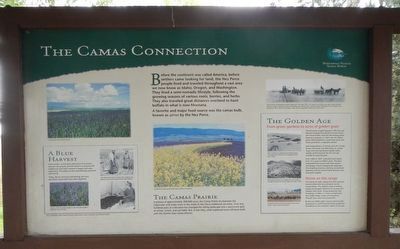
Captions: (upper left) A spring view of the Camas Prairie; (center) Canola blooms light up the fertile Camas Prairie in the Spring.; (top right) One of the first self-propelled combines in the early 1900s. The wagons pictured here are ready to take harvested wheat to storage. A big part of the job was taking care of the horses. Irishman Joseph McDonald is on the combine. Sons Earl and J.B. are on the first two wagons. Earl's son Jim and grandson Mike now run the ranch.; (A Blue Harvest side-bar) Camas, which has pedals ranging in color from dark purple to light blue, blooms in May. Nez Perce women harvest camas with a digging stick (upper right) and examine cooked camas bulbs (lower right).; (The Golden Age side-bar) Hard working men, aided by horse-drawn wagons harvested heavy wheat north of Grangeville in the early 1900s. Many bands of sheep were trailed across the prairie to the high mountains for summer feed in the early 1900s. Twenty-first Century cattle production on the Camas Prairie is often a family commitment.
A favorite and major food source was the camas bulb, known as qémes by the Nez Perce.
The Camas Prairie
A plateau of approximately 200,000 acres, the Camas Prairie lies between the Clearwater and Snake rivers in the midst of Nez Perce traditional-use areas. Over one hundred years of cultivation has changed the rolling landscape into a patchwork quilt of wheat, canola, and oat fields. But, in late May, small unplowed areas still burst forth with the familiar blue camas blooms.
(side-bar on left:)
A Blue Harvest
Camas bulbs, which grow about four to six inches beneath the ground, are harvested in a centuries-old tradition by Nez Perce women in August and early September. The bulbs are then painstakingly prepared and stored.
(side-bar on right:)
The Golden Age
From green gardens to acres of golden grain
The discovery of gold deposits in Elk City and Florence brought thousands of miners across the Camas Prairie. Food for the mining camps became a necessity. In 1863 near Mt. Idaho, James Odie fashioned a homemade plow and broke ground for a vegetable garden.
Early husbandmen L.P. Brown, John M. Crooks, Aurora Shumway, and Seth Jones, Sr. sowed larger and more productive garden plots, quickly confirming that the rich soil was suitable for growing grain.
From 1863 to 1867, cultivated land soared from 14.5 acres to 9,096.5 acres. The plow embroidered the prairie with both texture and design, forever changing the landscape. The thrashing machine, tramway and railroad followed, and the Camas Prairie became a dry land grain supplier.
Home on the range
The raising of cattle, sheep and swine evolved hand-in-hand with soil cultivation on the Camas Prairie. The need for meat at mining camps encouraged cattlemen to increase and improve their herds. Sheep production also flourished. In 1864, L.P. Brown owned more than 6,000 sheep. Sheep and hog drives through town were not uncommon.
By the year 2000, Idaho County had 414,500 grazing acres, confirming that stock production contributes to the economic vitality of the area.
Erected by Northwest Passage Scenic Byway and All-American Road.
Topics. This historical marker is listed in these topic lists: Agriculture • Native Americans • Natural Features.
Location. 45° 55.93′ N, 116° 7.916′ W. Marker is in Grangeville, Idaho, in Idaho County. Marker is on Pine Street near U.S. 95, on the right when traveling south. Touch for map. Marker is at or near this postal address: 285 Pine Street, Grangeville ID 83530, United States of America. Touch for directions.
Other nearby markers. At least 8 other markers are within 3 miles of this marker, measured as the crow flies. Gold Pans and Whipsaws (here, next to this marker); Home on the Grange (here, next to this marker); The Eimers Legacy (a few steps from this marker); The Camas Prairie Mammoth (a few steps from this marker); A Mammoth Discovery (a few steps from this marker); Tolo, Alab-lemot (a few steps from this marker); The ADVANCE Steam Traction Engine (approx. 0.6 miles away); Mount Idaho (approx. 3.1 miles away). Touch for a list and map of all markers in Grangeville.
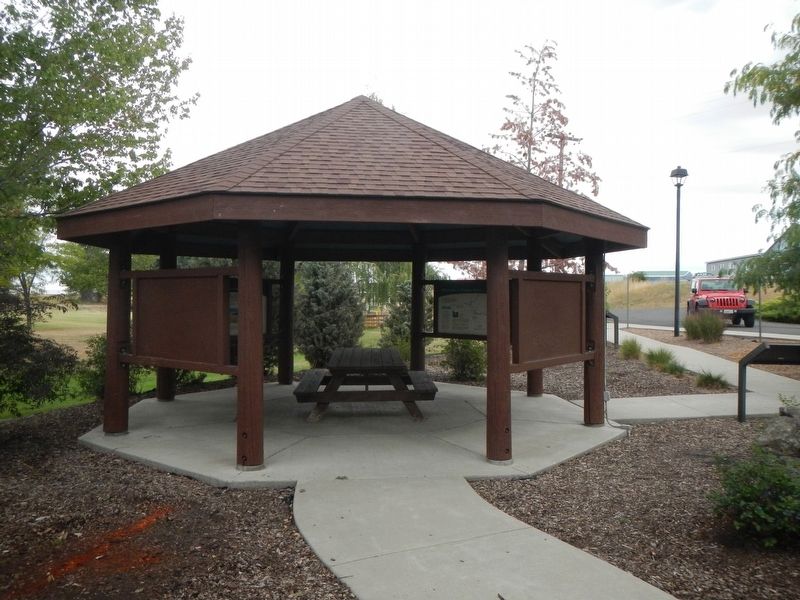
More about this marker. This marker is located in Eimers Park.
Credits. This page was last revised on October 18, 2019. It was originally submitted on October 18, 2019, by Barry Swackhamer of Brentwood, California. This page has been viewed 189 times since then and 14 times this year. Photos: 1, 2. submitted on October 18, 2019, by Barry Swackhamer of Brentwood, California.
