Defiance in Defiance County, Ohio — The American Midwest (Great Lakes)
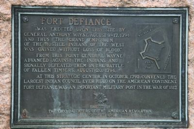
Fort Defiance
From this point General Wayne advanced against the Indians and signally defeated them in the Battle of Fallen Timbers, August 20, 1794.
At this strategic center, in October, 1792, convened the largest Indian Council ever held on the American continent. Fort Defiance was an important military post in the War of 1812.
Erected 1925 by The Ohio Daughters of the American Revolution.
Topics and series. This historical marker is listed in these topic lists: Forts and Castles • Military • Native Americans • War of 1812 • Wars, US Indian. In addition, it is included in the Daughters of the American Revolution series list. A significant historical month for this entry is October 1792.
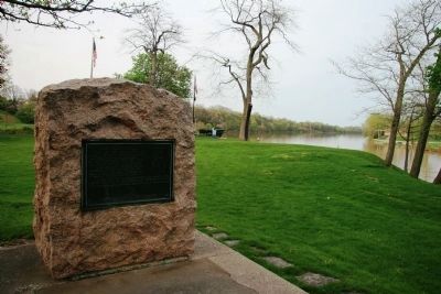
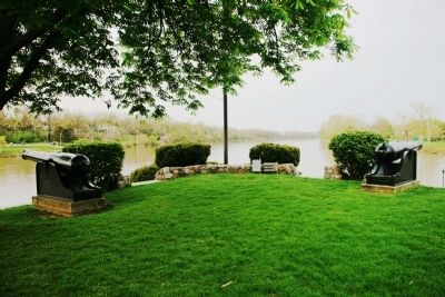
Location. 41° 17.241′ N, 84° 21.443′ W. Marker is in Defiance, Ohio, in Defiance County. Marker is at the intersection of Fort Street and Washington Avenue, on the right when traveling west on Fort Street. This historical marker is situated on the southwest point of land, at the juncture of the Auglaize River with the Maumee River, in a historic park that is located just to the east of the Defiance Public Library. Touch for map. Marker is at or near this postal address: 324 Fort Street, Defiance OH 43512, United States of America. Touch for directions.
Other nearby markers. At least 8 other markers are within walking distance of this marker. Anthony Wayne's Fort Defiance (a few steps from this marker); Reinforcement Work (a few steps from this marker); Frontier Fort 1794-1796 (a few steps from this marker); Location Of The Bake Oven (a few steps from this marker); South Blockhouse (a few steps from this marker); Fort Defiance Flagstaff (a few steps from this marker); West Blockhouse (a few steps from this marker); Construction Of Fort Defiance (a few steps from this marker). Touch for a list and map of all markers in Defiance.
More about this marker. The marker is one of several markers located at the actual site of Fort Defiance. The marker can be found on the edge of the actual fortification, just outside the low lying earthworks that mark the outline of the fort.
Regarding Fort Defiance. Regarding Fort Defiance, Charles E. Slocum (a native of Defiance, Ohio) writes in his book, "History of the Maumee River Basin" (copyright 1905), the following: "Fort Defiance was the strongest fortification built by General Wayne - where he could defy the hostile Aborigines and the British - and he styled it "an important
and Formidable Fort." His careful study of the strong British Fort Miami induced the strengthening of Fort Defiance after the return of the army from the Battle of Fallen Timber, it being thought possible, if not probable that the Aborigines might rally and, aided again by the British, endeavor to destroy it. It was principally built between the 8th August and the 14th September, 1794."
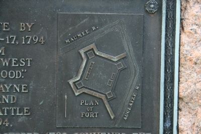
"Outside the Palisades and Blockhouses there was a glacis or wall of earth eight feet thick, which sloped outwards and upwards, and was supported on its outer side by a log wall and fascines. A ditch encircled the entire works excepting the east side of the east Blockhouse which was near the precipitous bank of the Auglaise River along which was a line of fagots. The Ditch was fifteen feet wide and eight feet deep. It was protected by pickets eleven feet long and nearly a foot apart, secured to the log walls, projecting over the Ditch at an angle of forty-five degrees. The outlines of these earthworks are yet well maintained."
"Generally this Fort was garrisoned by about one hundred men, with an armament of several small field cannon which had been dismounted and brought through the forest on the backs of horses. Captain William March Snook commanded it for three or four months, and Major (afterwards Colonel) Thomas Hunt about eighteen months. It was probably dismantled and abandoned
by the United States soldiers about the 1st June, 1796."
"The site has continued the property of the (Village and the) City of Defiance, and it is freely open as a Public Park. This Fort Defiance Park was surveyed, in common with the other historic places along the Maumee River, in August, 1888, under the supervision of Colonel O. M. Poe, of the Corps of Engineers of the United States Army, and in obediance to Act of Congress approved 24th May, 1888. A monument was recommended for this place to cost five thousand dollars; but the bill was not passed....The Trustees of The Defiance Public Library, by permission of the City Council, located the Carnegie Library building in this Park west of the Earthworks in 1904."
Credits. This page was last revised on June 16, 2016. It was originally submitted on May 8, 2009, by Dale K. Benington of Toledo, Ohio. This page has been viewed 2,659 times since then and 102 times this year. Photos: 1, 2, 3, 4. submitted on May 8, 2009, by Dale K. Benington of Toledo, Ohio. • Kevin W. was the editor who published this page.


