Austin in Travis County, Texas — The American South (West South Central)
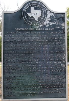
Santiago del Valle Grant
McKinney Falls State Park lies in the center of an early Texas land grant that originally fell within the empresario contract of Texian hero Ben Milam.
Ten leagues of land were transferred in 1832 to Santiago del Valle, who at that time was secretary of the Mexican government of Coahuila y Texas and had previously served as a member of the Mexican Congress.
In 1835 Del Valle sold nine leagues of his land to Michel Menard, who in 1838 helped found the town of Galveston.
Thomas F. McKinney, one of the Menard's business associates, purchased the Del Valle grant in 1839. His family probably was the first of the property owners to live on the land, which they began to occupy during the late 1840s. McKinney had sold all but approximately 2,800 acres of the land by the time of his death in 1873.
The lands within the Santiago del Valle grant remained primarily agricultural during the late nineteenth and early twentieth centuries. Communities such as Bluff Springs, Pilot Knob, Creedmoor, and Del Valle began to develop during this period. While the northern part of the Del Valle grant has become increasingly urbanized, the southern portion remains largely rural, and is preserved in this State Park.
Erected 1984 by Texas Historical Commission. (Marker Number 15083.)
Topics and series. This historical marker is listed in these topic lists: Agriculture • Native Americans • Settlements & Settlers. In addition, it is included in the El Camino Real de los Tejas National Historic Trail series list. A significant historical year for this entry is 1832.
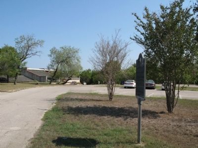
Location. 30° 10.999′ N, 97° 43.496′ W. Marker is in Austin, Texas, in Travis County. Marker can be reached from McKinney Falls Parkway south of Burleson Road, on the right when traveling west. The marker is located in the parking lot of the visitor center of McKinney Falls State Park. Touch for map. Marker is in this post office area: Austin TX 78744, United States of America. Touch for directions.
Other nearby markers. At least 8 other markers are within 4 miles of this marker, measured as the crow flies. Collins Cemetery (approx. 1.6 miles away); Richard Overton Healing Garden (approx. 2.6 miles away); Onion Creek Lodge 220, A.F. & A.M. (approx. 2.8 miles away); Doyle Farm (approx. 3 miles away); Cementerio Mexicano de Maria de la Luz (approx. 3.3 miles away); Boggy Creek Masonic Cemetery (approx. 3.3 miles away); The Original Skyline Club Sign (approx. 3˝ miles away); Ward Memorial United Methodist Church (approx. 3˝ miles away). Touch for a list and map of all markers in Austin.
Also see . . .
1. McKinney Falls State Park, Wikipedia article
. Historical marker is located at the McKinney Falls State Park vistor center. (Submitted on September 8, 2009, by Richard Denney of Austin, Texas.)
2. Camino Del Norte. The full title of this book says it all: "Camino Del Norte: How a Series of Watering Holes, Fords, And Dirt Trails Evolved into Interstate 35 in Texas". McKinney Falls was one of those watering holes on one branch of the Camino Real through Texas. (Submitted on September 8, 2009, by Richard Denney of Austin, Texas.)
Additional keywords. Camino Real de Tejas
Credits. This page was last revised on February 1, 2023. It was originally submitted on September 7, 2009. This page has been viewed 2,211 times since then and 94 times this year. Last updated on October 29, 2020, by Richard Denney of Austin, Texas. Photos: 1, 2. submitted on September 7, 2009, by Richard Denney of Austin, Texas. • J. Makali Bruton was the editor who published this page.

