Washington Township near Morrow in Warren County, Ohio — The American Midwest (Great Lakes)
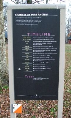
Changes at Fort Ancient
Many changes have occurred at Fort Ancient over the last 2,000 years. Hopewell Indians built the site and used it as a ceremonial and social gathering area. The Fort Ancient Indians lived in the South Fort 500 years after the Hopewell people left. There is no evidence that the Fort Ancient Indians used the Middle or North Fort areas. The timeline below shows major occurrences at Fort Ancient.
100BC - AD500 Constructed and used by Hopewell Indians
AD900 - AD1600 Fort Ancient Indians inhabit South Fort area
Ca.1798 Chillicothe-Lebanon turnpike built through the site
1809 First reported and surveyed. Published in Port Folio magazine
1810 - 1880 Several surveys and examinations of the site
1881-1889 First systematic excavation by Warren K. Moorehead
1891 Fort Ancient purchased by state to be operated by Ohio Historical Society
1893 - 1936 Anderson Village site excavated by Clifford Anderson
1908 Portions excavated by William C. Mills
1920 First museum opened near Little Miami River
1932 - 1936 Used as Civilian Conservation Corps base camp. Earthworks renovated
1939 - 1940 Portions excavated by Richard Morgan
1968 Second museum dedicated
1982 - 1991 Portions excavated by Patricia Essenpreis
1987 - 1996 Portions excavated by Robert Connolly
1998 New museum dedicated
Today In order to preserve the past for the future, we must care for it today.
Erected by The Ohio Historical Society.
Topics and series. This historical marker is listed in these topic lists: Exploration • Forts and Castles • Landmarks • Man-Made Features • Native Americans • Natural Features • Notable Places • Settlements & Settlers. In addition, it is included in the Civilian Conservation Corps (CCC) series list. A significant historical year for this entry is 1798.
Location. 39° 23.994′ N, 84° 5.635′ W. Marker is near Morrow, Ohio, in Warren County. It is in Washington Township. Marker is about 175 feet WNW of the main picnic shelter on Fort Ancient State Memorial, near the park access road. Touch for map. Marker is at or near this postal address: 6123 Ohio Route 350, Oregonia OH 45054, United States of America. Touch for directions.
Other nearby markers. At least 8 other markers are within walking distance of this marker. The Great Gateway (a few steps from this marker); Fort Ancient (within shouting distance of this marker); Fort Ancient Earthworks (within shouting distance of this marker); The Civilian Conservation Corps (about 300 feet away, measured in a direct line); Earthworks Trail
(about 500 feet away); Stages of Construction / Crescent Mounds (approx. 0.2 miles away); The Myth of the Mound Builders (approx. 0.2 miles away); Fort Ancient Dwelling (approx. 0.2 miles away). Touch for a list and map of all markers in Morrow.
Also see . . .
1. Fort Ancient Earthworks. Ohio History central website entry (Submitted on January 19, 2010, by William Fischer, Jr. of Scranton, Pennsylvania.)
2. Fort Ancient State Park. Ohio State parks website entry (Submitted on July 23, 2022, by Larry Gertner of New York, New York.)
Credits. This page was last revised on February 6, 2023. It was originally submitted on January 19, 2010, by William Fischer, Jr. of Scranton, Pennsylvania. This page has been viewed 728 times since then and 12 times this year. Photos: 1, 2. submitted on January 19, 2010, by William Fischer, Jr. of Scranton, Pennsylvania.

