Near Smithfield in Isle of Wight County, Virginia — The American South (Mid-Atlantic)
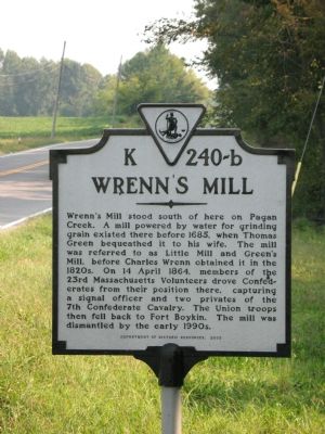
Wrenn’s Mill
Erected 2003 by Department of Historic Resources. (Marker Number K-240-b.)
Topics and series. This historical marker is listed in these topic lists: Colonial Era • Industry & Commerce • War, US Civil • Waterways & Vessels. In addition, it is included in the Virginia Department of Historic Resources (DHR) series list. A significant historical date for this entry is April 14, 1864.
Location. 37° 2.079′ N, 76° 39.834′ W. Marker is near Smithfield, Virginia, in Isle of Wight County. Marker is at the intersection of Old Stage Highway (Route 10) and Wrenns Mill Road, on the left when traveling north on Old Stage Highway. Touch for map. Marker is in this post office area: Smithfield VA 23430, United States of America. Touch for directions.
Other nearby markers. At least 8 other markers are within 3 miles of this marker, measured as the crow flies. Old Town (approx. 1.6 miles away); Bennett’s Plantation (approx. 2.2 miles away); Basse’s Choice (approx. 2.2 miles away); The Historic James and its Tributaries (approx. 2.4 miles away); Fort Boykin during the Civil War (approx. 2˝ miles away); Camp Eustis Attacks Fort Boykin (approx. 2˝ miles away); Fort Boykin Memorial (approx. 2˝ miles away); The Fort's Last Private Owners (approx. 2˝ miles away). Touch for a list and map of all markers in Smithfield.
Credits. This page was last revised on March 5, 2024. It was originally submitted on September 23, 2007, by Laura Troy of Burke, Virginia. This page has been viewed 2,589 times since then and 149 times this year. Photo 1. submitted on September 23, 2007, by Laura Troy of Burke, Virginia. • J. J. Prats was the editor who published this page.
