Near Chatsworth in Murray County, Georgia — The American South (South Atlantic)
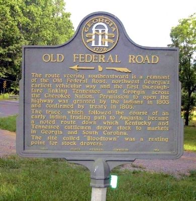
Old Federal Road
<------<<<<
The trace, which followed the course of an early Indian trading path to Augusta, became a noted route down which Kentucky and Tennessee cattlemen drove stock to markets in Georgia and South Carolina.
The site called “Bloodtown” was a resting point for stock drovers.
Erected 1954 by Georgia Historical Commission. (Marker Number 105-7.)
Topics and series. This historical marker is listed in these topic lists: Agriculture • Animals • Industry & Commerce • Native Americans • Roads & Vehicles • Settlements & Settlers. In addition, it is included in the Georgia Historical Society series list. A significant historical year for this entry is 1803.
Location. 34° 38.132′ N, 84° 41.518′ W. Marker is near Chatsworth, Georgia, in Murray County. Marker is on Old U.S. 411, 0.8 miles south of Coniston Road, on the right when traveling north. Touch for map. Marker is in this post office area: Chatsworth GA 30705, United States of America. Touch for directions.
Other nearby markers. At least 8 other markers are within 11 miles of this marker, measured as the crow flies. Fort Gilmer (approx. 2 miles away); De Soto in Georgia (approx. 2.2 miles away); Old Holly Creek P.O. (approx. 8 miles away); Field's Mill & Ferry (approx. 9.4 miles away); Cohutta-Chattahoochee Scenic Byway (approx. 9.8 miles away); Fort Mountain (approx. 9.8 miles away); Mystery Shrouds Fort Mountain (approx. 9.9 miles away); Murray County (approx. 10.1 miles away). Touch for a list and map of all markers in Chatsworth.
Credits. This page was last revised on February 1, 2020. It was originally submitted on August 1, 2010, by David Seibert of Sandy Springs, Georgia. This page has been viewed 703 times since then and 26 times this year. Photo 1. submitted on August 1, 2010, by David Seibert of Sandy Springs, Georgia. • Craig Swain was the editor who published this page.
Editor’s want-list for this marker. A wide shot of the marker and its surroundings. • Can you help?
