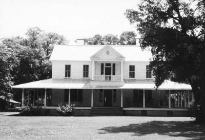
Near Quinby in Florence County, South Carolina — The American South (South Atlantic)
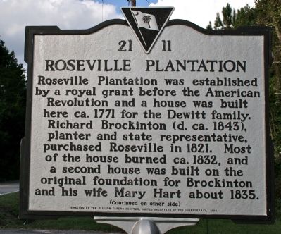
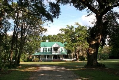
Roseville Plantation
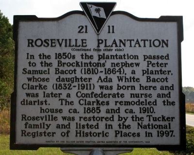
In the 1850s the plantation passed to the Brockintons' nephew Peter Samuel Bacot (1810-1864), a planter, whose daughter Ada White Bacot Clarke (1832-1911) was born here and was later a Confederate nurse and diarist. The Clarkes remodeled the house ca. 1885 and ca. 1910. Roseville was restored by the Tucker family and listed in the National Register of Historic Places in 1997.
Erected 1998 by the Ellison Capers Chapter, United Daughters of the Confederacy. (Marker Number 21-11.)
Topics and series. This historical marker is listed in these topic lists: Agriculture • Colonial Era • Settlements & Settlers • War, US Civil. In addition, it is included in the United Daughters of the Confederacy series list. A significant historical year for this entry is 1771.
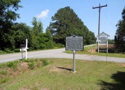
Location. 34° 16.625′ N, 79° 42.177′ W. Marker is near Quinby, South Carolina , in Florence County. Marker is on North Williston Road (State Highway 327) ¼ mile north of E. Pocket Road, on the right when traveling north. Touch for map. Marker is at or near this postal address: 3636 North Williston Road, Florence SC 29506, United States of America. Touch for directions.
Other nearby markers. At least 8 other markers are within 6 miles of this marker, measured as the crow flies. Roseville Plantation Slave And Freedman's Cemetery / Clarke Cemetery (approx. 0.3 miles away); Ney School / Back Swamp School (approx. 0.9 miles away); Christ Episcopal Church (approx. 2½ miles away); William R. Johnson House / The Columns (approx. 4.7 miles away); Williamson's Bridge (approx. 4.8 miles away); Pleasant Grove Church (approx. 5.2 miles away); Moses S. Haynsworth (approx. 5.4 miles away); Andrew Hunter (approx. 5½ miles away). Touch for a list and map of all markers in Quinby.
Also see . . .
1. South Carolina Department of Archives and History. (Submitted on November 6, 2010, by Michael Sean Nix of Spartanburg, South Carolina.)
2. Roseville Plantation - Florence, Florence County, South Carolina SC. (Submitted on May 10, 2011, by PaulwC3 of Northern, Virginia.)
Credits. This page was last revised on February 2, 2020. It was originally submitted on October 28, 2010, by David Bullard of Seneca, South Carolina. This page has been viewed 1,680 times since then and 75 times this year. Photos: 1, 2. submitted on October 28, 2010, by David Bullard of Seneca, South Carolina. 3. submitted on May 10, 2011, by PaulwC3 of Northern, Virginia. 4. submitted on October 28, 2010, by David Bullard of Seneca, South Carolina. 5. submitted on November 6, 2010, by Michael Sean Nix of Spartanburg, South Carolina. • Bill Pfingsten was the editor who published this page.
