Shockoe Bottom in Richmond, Virginia — The American South (Mid-Atlantic)
Lumpkins Jail
Archeology Study Site
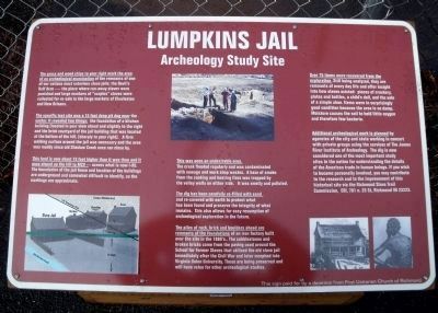
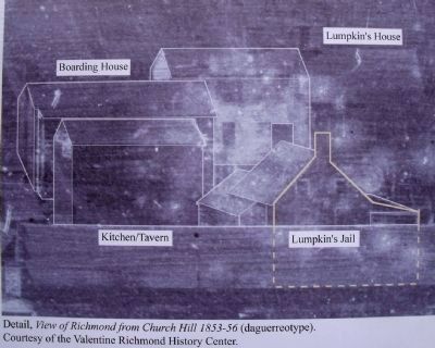
The specific test site was a 15 foot deep pit dug near the center. It revealed two things: the foundation of a kitchen building (located in your view ahead and slightly to the right and the brick courtyard of the jail building that was located at the bottom of the hill, [sharply to your right]. A firm walking surface around the jail was necessary and the area was muddy since old Shockoe Creek once ran close by.
This land is now about 15 feet higher than it was then and it once sloped up the hill to MCV --- across what is now I-95. The boundaries of the jail fence and location of the buildings are underground and somewhat difficult to identity, so the markings are approximate.
This was once an undesirable area. The creek flooded regularly and was contaminated with sewage and work shop wastes. A haze of smoke from the cooking and heating fires was trapped by the valley walls on either side. It was smelly and polluted.
The dig has been carefully re-filled with sand and re-covered with earth to protect what has been found and preserve the integrity of what remains. This also allows for easy resumption of archeological exploration in the future.
The piles of rock, brick and boulders ahead are remnants of the foundations of an iron factory built over the site in the 1880’s.. The cobblestones and broken bricks came from the paving used around the School for Former Slaves that utilized the old slave jail immediately after the Civil War and later morphed into Virginia Union University. These are being preserved and will have value for other archeological studies.
Over 75 items were recovered from the exploration. Still being analyzed, they are remnants of every day life and offer insight into how slaves existed: pieces of crockery, plates and bottles, a child’s doll, and the sole of a simple shoe. Items were in surprisingly good condition because the area is so damp. Moisture causes the soil to hold little oxygen and therefore few bacteria.
Additional archeological work is planned by agencies of the city and state working in concert with private groups using the services of The James River Institute of Archeology. The dig is now considered one of the most important study sites in the nation for understanding the details of the American trade in human beings. If you wish to become personally involved, you may contribute to the research and to the improvement of this historical site via the Richmond Slave Trail Commission, EDI, 701 n. 25 St, Richmond VA 23223.
This sign paid for by a donation from First Unitarian Church of Richmond
Erected by First Unitarian Church of Richmond.
Topics and series. This historical marker is listed in these topic lists: African Americans • Anthropology & Archaeology • Law Enforcement. In addition, it is included in the Historically Black Colleges and Universities, and the Unitarian Universalism (UUism) series lists.
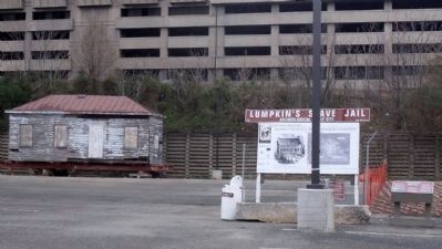
Location. This marker has been replaced by another marker nearby. It was located near 37° 32.178′ N, 77° 25.72′ W. Marker was in Richmond, Virginia. It was in Shockoe Bottom. Marker could be reached from East Franklin Street near North 15th Street. This marker is located in a parking lot between E Franklin St and Broad St just east of I-95. Touch for map. Marker was in this post office area: Richmond VA 23219, United States of America. Touch for directions.
Other nearby markers. At least 8 other markers are within walking distance of this location. Winfree Cottage (a few steps from this marker); a different marker also named Lumpkin's Jail (within shouting distance of this marker); Slave Rebellion leader Gabriel Prasser… (about 300 feet away, measured in a direct line); Execution of Gabriel (about 400 feet away); Richmond's African Burial Ground (about 700 feet away); The Triangle (about 700 feet away); Kahal Kadosh Beth Shalome (about 700 feet away); Odd Fellows Hall (about 800 feet away). Touch for a list and map of all markers in Richmond.
Related marker. Click here for another marker that is related to this marker. New Marker At This Location titled "Lumpkin's Jail".
Also see . . . Lumpkin's Jail Project. James River Institute for Archaeology (Submitted on March 5, 2011.)
Credits. This page was last revised on February 18, 2023. It was originally submitted on March 5, 2011, by Bernard Fisher of Richmond, Virginia. This page has been viewed 1,945 times since then and 98 times this year. Photos: 1. submitted on January 4, 2010, by Bernard Fisher of Richmond, Virginia. 2, 3. submitted on December 28, 2009, by Bernard Fisher of Richmond, Virginia. 4. submitted on March 5, 2011, by Bernard Fisher of Richmond, Virginia.


