Sir Richard's Landing
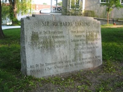
Here at the river’s edge the settlers of Watertown led by Sir Richard Saltonstall landed July 30, 1630.
Here Reverend George Phillips protest in 1632 against taxation without representation struck the first note of civil liberty heard in this wilderness.
All of the territory from Sparks Street to Mount Auburn Bridge, originally a part of Watertown, was annexed to Cambridge in 1754.
Erected 1948 by Historical Society of Watertown.
Topics. This historical marker is listed in these topic lists: Colonial Era • Settlements & Settlers • Waterways & Vessels. A significant historical date for this entry is July 30, 1924.
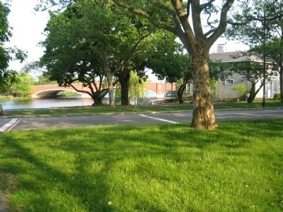
Location. Marker has been reported missing. It was located near 42° 22.473′ N, 71° 8.277′ W. Marker was in Cambridge, Massachusetts, in Middlesex County. Marker was at the intersection of Gerry's Landing Road and Greenough Boulevard on Gerry's Landing Road. This monument sits in front of the Cambridge Boat Club in a large and heavily trafficked intersection of Gerry's landing and Greenough Boulevard. It is on the western side of the Eliot Bridge and diagonally across from the from Buckingham, Brown and Nichols School and the rear of Mount Auburn Hospital. Touch for map.
Other nearby markers. At least 8 other markers are within walking distance of this location. A different marker also named Sir Richard's Landing (here, next to this marker); Vassall-Craigie-Longfellow House (approx. 0.6 miles away); Emery T. Morris (approx. 0.6 miles away); The Shick House & Farm (approx. ¾ mile away); Harriet A. Jacobs (approx. ¾ mile away); Near this spot… (approx. 0.8 miles away); Gen. Henry Knox Trail (approx. 0.8 miles away); Old Charlestown – Watertown Path (approx. 0.8 miles away). Touch for a list and map of all markers in Cambridge.
More about this marker. This marker replaced an earlier marker placed by the Massachusetts Bay Colony Tercentenary Commission. According to "Historical Markers of the Massachusetts Bay Colony," the marker read, "First Settlement. Site of first settlement of Watertown in 1530. Here at the first meetinghouse the Reverend George Phillips protested against taxation without representation in 1632, which resulted in the people participating in the law-making power."
Additional keywords. town boundary
Credits. This page was last revised on October 8, 2020. It was originally submitted on June 13, 2011, by David Russo of Watertown, Mass.. This page has been viewed 973 times since then and 36 times this year. Photos: 1, 2, 3. submitted on June 13, 2011, by David Russo of Watertown, Mass.. • Bill Pfingsten was the editor who published this page.


