Mound in Hennepin County, Minnesota — The American Midwest (Upper Plains)
Minnetonka -- Queen of the Inland Lakes
Inscription.
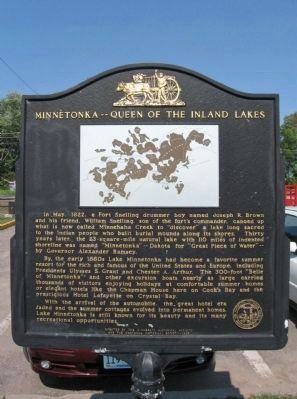
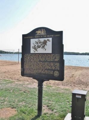
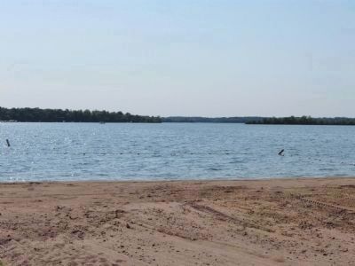
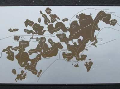
In May, 1822, a Fort Snelling drummer boy named Joseph R. Brown and his friend, William Snelling, son of the fort's commander, canoed up what is now called Minnehaha Creek to "discover" a lake long sacred to the Indian people who built burial mounds along its shores. Thirty years later, the 23-square-mile natural lake with 110 miles of indented shoreline was named "Minnetonka" -- Dakota for "Great Piece of Water" -- by Governor Alexander Ramsey.
By the early 1880s Lake Minnetonka had become a favorite summer resort for the rich and famous of the United States and Europe, including Presidents Ulysses S. Grant and Chester A. Arthur. The 300-foot "Belle of Minnetonka" and other excursion boats nearly as large carried thousands of visitors enjoying holidays at comfortable summer homes or elegant hotels like the Chapman House here on Cook's Bay and the prestigious Hotel Lafayette on Crystal Bay.
With the arrival of the automobile, the great hotel era faded and the summer cottages evolved into permanent homes. Lake Minnetonka is still known for its beauty and its many recreational opportunities.
Erected by the Minnesota Historical Society
and the Westonka Historical Society - 1985
Erected 1985 by The Minnesota Historical Society and the Westonka Historical Society.
Topics and series. This historical marker is listed in these topic lists: Cemeteries & Burial Sites • Native Americans • Waterways & Vessels. In addition, it is included in the Minnesota Historical Society series list. A significant historical month for this entry is May 1822.
Location. 44° 55.713′ N, 93° 40.252′ W. Marker is in Mound, Minnesota, in Hennepin County. Marker is on Bartlett Boulevard (County Road 110) 0.7 miles south of Lynwood Boulevard (County Road 15), on the left when traveling south. Marker is in Surfside Park at the beach parking lot. Touch for map. Marker is in this post office area: Mound MN 55364, United States of America. Touch for directions.
Other nearby markers. At least 8 other markers are within 4 miles of this marker, measured as the crow flies. SurfSide Park (about 300 feet away, measured in a direct line); 9/11 Memorial (approx. 0.3 miles away); Veterans Monument (approx. 0.7 miles away); Clearing the Land, Making a Home (approx. 3.8 miles away); Grimm Farm Historic Site (approx. 3.8 miles away); Commemorating Wendelin Grimm (approx. 3.8 miles away); "Golden Buckle of the Dairy Belt" (approx. 3.8 miles away); Nike Missiles: Dedicated to Defense (approx. 4.1 miles away). Touch for a list and map of all markers in Mound.
More about this marker. Surfside Park & Beach, where this
marker is located, was formerly known as Mound Bay Park from 1963 through October 2011.
Also see . . . Lake Minnetonka. Wikipedia entry. (Submitted on September 7, 2012.)
Credits. This page was last revised on October 26, 2023. It was originally submitted on September 7, 2012, by Keith L of Wisconsin Rapids, Wisconsin. This page has been viewed 824 times since then and 27 times this year. Photos: 1, 2, 3, 4. submitted on September 7, 2012, by Keith L of Wisconsin Rapids, Wisconsin.


