Lutherstadt Wittenberg in Wittenberg, Saxony-Anhalt, Germany — Central Europe
Wittenberg's Water-Piping System
Wittenberger Röhrwasser
Inscription.
a technical monument from the 16th century
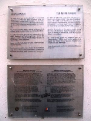
1n 1556 a group of distinguished local residents (Hieronymus Krapp, Christoff Kelner, Hans Lufft, Lucas Cranach, Caspar Pfreundt, Conradt Rühel and Christoff Schramm) formed a "Piping Union" in order to have water mains constructed. This water supply system later became known as the "Old Maiden Water Piping System" (Altes Jungfernröhrwasser). The water was piped in hollowed tree trunks connected with iron joints from a spring some 5 km north-east of Wittenberg with outlets (so-called "Portions") in town. These outlets (fountains) were situated in the courtyards of these seven residents of Wittenberg. An eighth outlet was given to the famous and honoured Philipp Melanchthon for his house on Collegien Street.
Within three years - by 1559 - the second system, the so-called New Maiden Water Piping System, was constructed. Initially this had 22 outlets. Both system[s] were extended, supplying water to a total of 60 houses within the town in their heyday. Both the Old and the New Maiden Water Piping-Systems are still in operation today, supplying some 30 outlets within Wittenberg.
There wa[s] always a tap house installed between the main pipe and the extension to the outlet in the courtyard. That way it was possible to turn off the water when the Watermoney was not paid.
The tap house shown here (it is part of the New Maiden Water Supply System) is intended to make both local residents and guests of Wittenberg aware of this technical monument from the 16th century.
The Water Piping System is maintained by Verein Altes und Neues Jungfernröhrwasser der Lutherstadt Wittenberg e.V. und/and Stadtwerke Lutherstadt Wittenberg GmbH
19. Juli 1999
——————————
Ein technisches Denkmal aus dem 16. Jahrhundert
Im Jahr 1556 schlossen sich die angesehenen Wittenberger Bürger Hieronymus Krapp, Christoff Kelner, Hans Lufft, Lucas Cranach, Caspar Pfreundt, Conradt Rühel und Christoff Schramm zu einer Röhrwassergewerkschaft zusammen und ließen ein Wasserversorgungssystem bauen, das später "Altes Jungfernröhrwasser" genannt wurde. Das System bestand aus ca. 5 km nordöstlich Wittenbergs gelegenen Quellfassungen, die das Wasser im freien Gefällen durch Holzrohrleitungen zu den Auslaufstellen im Stadtzentrum, den sogenannten "Portionen" leiteten. Die Portionen befanden sich auf den Höfen dieser sieben Wittenberger Burger, eine
achte Portion wurde dem berühmten und verehrten Philipp Melanchthon für sein Haus in der Collegienstraße geschenkt.
Bereits drei Jahre später, im Jahr 1559, wurde das zweite System, das "Neue Jungfernröhrwasser", mit anfänglich 22 Portionen gebaut. Beide Systeme wurden erweitert, so dass sich zeitweise bis zu 60 Portionen in den Höfen der Stadt befanden. Noch heute sind die beiden Systeme des Alten und des Neuen Jungfernröhrwassers in Betrieb und versorgen etwa 30 Portionen in der Wittenberger Alstadt.
Am Abzweig zwischen Hauptleitung und Anschlußleitung zur Portion lag jeweils ein Hahnhaus. Dieses machte es möglich, den Zufluss des Wassers zu sperren, sobald die Zahlung des Wasser-geides ausblieb.
Das hier gezeigte Hahnhaus (es gehört zum System des Neuen Jungfernröhrwassers) soll Wittenberger Bürger und Gäste auf dieses technische Denkmal aus dem 16. Jahrhundert aufmerksam machen.
Erected 1999 by Rotary Club Lutherstadt Wittenberg.
Topics and series. This historical marker is listed in these topic lists: Charity & Public Work • Environment • Man-Made Features • Waterways & Vessels. In addition, it is included in the Rotary International series list. A significant historical year for this entry is 1556.
Location. 51° 51.962′ N, 12° 38.638′
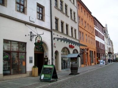
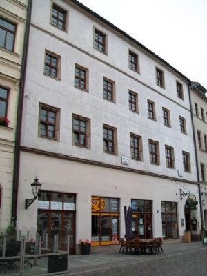
E. Marker is in Lutherstadt Wittenberg, Sachsen-Anhalt (Saxony-Anhalt), in Wittenberg. Marker is at the intersection of Markt and Collegienstraße, on the right when traveling east on Markt. Marker is near the southeast corner of the Market Square (Marktplatz). Touch for map. Marker is at or near this postal address: Markt 6, Lutherstadt Wittenberg ST 06886, Germany. Touch for directions.
Other nearby markers. At least 8 other markers are within walking distance of this marker. The Beyer Courty (here, next to this marker); Cranach-Hof (within shouting distance of this marker); Martin Luther (within shouting distance of this marker); Philipp Melanchthon (within shouting distance of this marker); Corpus Christi Chapel / Fronleichnamskapelle (within shouting distance of this marker); Mains Water Well on the Market Square (about 90 meters away, measured in a direct line); Lucas Cranach (about 90 meters away); a different marker also named Cranach-Hof (about 90 meters away). Touch for a list and map of all markers in Lutherstadt Wittenberg.
Related markers. Click here for a list of markers that are related to this marker.
Credits. This page was last revised on January 8, 2024. It was originally submitted on November 2, 2013, by William Fischer, Jr. of Scranton, Pennsylvania. This page has been viewed 590 times since then and 17 times this year. Photos: 1, 2, 3. submitted on November 2, 2013, by William Fischer, Jr. of Scranton, Pennsylvania.


