Near Jacksonboro in Colleton County, South Carolina — The American South (South Atlantic)
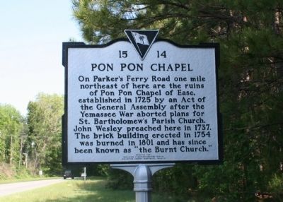
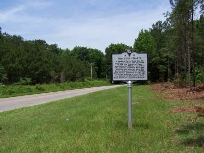
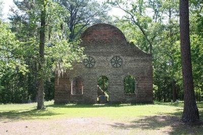
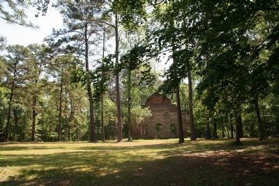
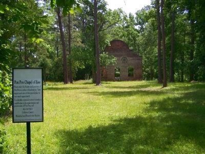
Pon Pon Chapel
Erected 1994 by Colleton County Historical Society, replacing a marker originally erected in 1970. (Marker Number 15-14.)
Topics. This historical marker is listed in these topic lists: Cemeteries & Burial Sites • Churches & Religion • Colonial Era • Wars, US Indian. A significant historical year for this entry is 1725.
Location. 32° 47.752′ N, 80° 29.288′ W. Marker is near Jacksonboro, South Carolina, in Colleton County. Marker is on Charleston Highway (County Route 64) south of Jacksonboro Rd (County Route 40), on the right when traveling north. The chapel itself is located just northeast of the intersection of Jacksonboro Rd. and Parker's Ferry Rd. Touch for map. Marker is in this post office area: Jacksonboro SC 29452, United States of America. Touch for directions.
Other nearby markers. At least 8 other markers are within 3 miles of this marker, measured as the crow flies. The Burial Site of Captain John Herbert Dent (approx. half a mile away); Bethel Presbyterian Church (approx. half a mile away); Ruins of Pon Pon Chapel of Ease (approx. 0.9 miles away); a different marker also named Pon Pon Chapel (approx. 0.9 miles away); Colonel Issac Hayne (approx. 0.9 miles away); Fateful Choices - The Hanging Of Isaac Hayne (approx. 0.9 miles away); Battle Of Parker's Ferry (approx. 0.9 miles away); Old Jacksonborough (approx. 3.1 miles away). Touch for a list and map of all markers in Jacksonboro.
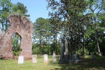
Also see . . . Pon Pon Chapel, National Register Properties in South Carolina. Listed in the National Register of Historic Places. Ruins of the church are stabilized and can be visited and also the adjacent cemetery containing the remains of Congressmen Aedanus Burke and O’Brien Smith, in addition to numerous local leaders. (Submitted on April 15, 2008, by Kevin W. of Stafford, Virginia.)
Additional commentary.
1. Pon Pon Chapel
Pon Pon Chapel of Ease of St. Bartholomew's Parish has been designated as the most historic site in Colleton County. St. Bartholomew's Parish has deep roots, having been established by the Colonial Assembly
in 1706. Though nearly destroyed by the Yemassee Indian uprising of 1715, the Parish recovered, establishing Pon Pon Chapel in 1725. The Rev. John Wesley preached at Pon Pon in 1737 during a visit to Colonial Carolina. After being burned twice, the last time in 1832 and was never rebuilt. It has since been known as the "Old Burnt Church."
Source: http://www.colletonhistoryandpreservation.com/history.html
— Submitted April 15, 2008, by Kevin W. of Stafford, Virginia.
Credits. This page was last revised on August 9, 2021. It was originally submitted on April 13, 2008, by Tracy Davis of Northfield, Minnesota. This page has been viewed 4,304 times since then and 77 times this year. Photos: 1. submitted on April 13, 2008, by Tracy Davis of Northfield, Minnesota. 2. submitted on May 24, 2008, by Mike Stroud of Bluffton, South Carolina. 3, 4, 5. submitted on April 13, 2008, by Tracy Davis of Northfield, Minnesota. 6. submitted on May 24, 2008, by Mike Stroud of Bluffton, South Carolina. • Kevin W. was the editor who published this page.
