Millwood in Clarke County, Virginia — The American South (Mid-Atlantic)
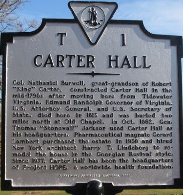
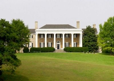
Carter Hall
Erected 2007 by Department of Historic Resources. (Marker Number T-1.)
Topics and series. This historical marker is listed in these topic lists: Architecture • Cemeteries & Burial Sites • Churches & Religion • Science & Medicine • Settlements & Settlers • War, US Civil. In addition, it is included in the Virginia Department of Historic Resources (DHR) series list. A significant historical year for this entry is 1813.
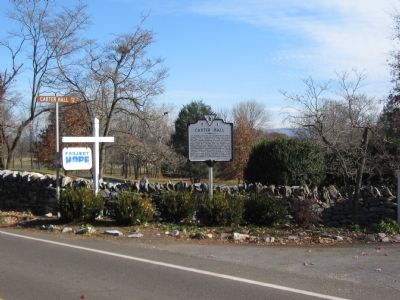
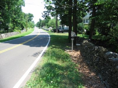
Location. 39° 4.351′ N, 78° 2.084′ W. Marker is in Millwood, Virginia, in Clarke County. Marker is at the intersection of Bishop Meade Highway ( Virginia Route 255) and Carter Hall Lane, on the right when traveling north on Bishop Meade Highway. Across the street from Christ Episcopal Church and Cunningham Chapel. Touch for map. Marker is in this post office area: Millwood VA 22646, United States of America. Touch for directions.
Other nearby markers. At least 8 other markers are within 2 miles of this marker, measured as the crow flies. Millwood (approx. ¼ mile away); The Burwell-Morgan Mill (approx. 0.3 miles away); Greenway Historic District (approx. one mile away); Blandy Experimental Farm (approx. 1½ miles away); Long Branch (approx. 1.7 miles away); Vinyard Fight (approx. 1.9 miles away); Saratoga (approx. 2 miles away); Town of Boyce (approx. 2 miles away). Touch for a list and map of all markers in Millwood.
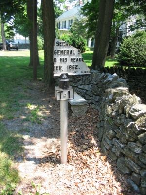
Regarding Carter Hall. This marker replaces a previous one also numbered T 1 with the same title. The old marker read:
The house was completed about 1792 by Nathaniel Burwell. Edmund Randolph, Governor of Virginia and Secretary of State, died here. General Stonewall Jackson had his headquarters here, October, 1862.
Erected by the Conservation & Development Commission.
In early 2007 the marker was reported as "badly damaged and only the post, number plate, and the bottom portion of the text remain" by a correspondent.
Also see . . . Carter Hall Conference Center. Description of facilities and a virtual tour of the estate. (Submitted on July 10, 2007, by Craig Swain of Leesburg, Virginia.)
Credits. This page was last revised on December 24, 2019. It was originally submitted on July 10, 2007, by Craig Swain of Leesburg, Virginia. This page has been viewed 2,824 times since then and 46 times this year. Last updated on April 10, 2014, by Linda Walcroft of Woodstock, Virginia. Photos: 1, 2. submitted on December 2, 2007, by Craig Swain of Leesburg, Virginia. 3. submitted on July 10, 2007, by Craig Swain of Leesburg, Virginia. 4. submitted on July 24, 2007, by Craig Swain of Leesburg, Virginia. 5, 6. submitted on July 10, 2007, by Craig Swain of Leesburg, Virginia. • Bill Pfingsten was the editor who published this page.
