Near King George in King George County, Virginia — The American South (Mid-Atlantic)
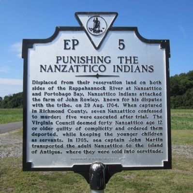
Punishing the Nanzattico Indians
Erected 2010 by Department of Historic Resources. (Marker Number EP-5.)
Topics and series. This historical marker is listed in these topic lists: Colonial Era • Industry & Commerce • Law Enforcement • Native Americans. In addition, it is included in the Virginia Department of Historic Resources (DHR) series list. A significant historical date for this entry is August 29, 1704.
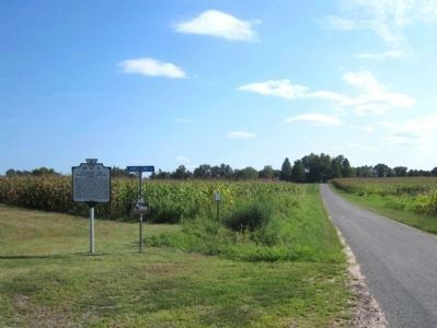
Location. 38° 10.579′ N, 77° 7.455′ W. Marker is near King George, Virginia, in King George County. Marker is on Nanzatico Lane (Virginia Route 698) 1˝ miles south of Salem Church Road (Virginia Route 625), on the left when traveling south. Located at the trailhead to Lands End Wildlife Management Area. Touch for map. Marker is in this post office area: King George VA 22485, United States of America. Touch for directions.
Other nearby markers. At least 8 other markers are within 4 miles of this marker, measured as the crow flies. King George County / Caroline County (approx. 3.3 miles away); James Madison's Birthplace (approx. 3.3 miles away); Emmanuel Church (approx. 3.3 miles away); Emmanuel Episcopal Church (approx. 3.3 miles away); This monument, until 1983 located on the Belle Grove Lawn (approx. 3.4 miles away); Port Royal Harbor (approx. 3˝ miles away); Port Royal (approx. 3˝ miles away); The Earliest Inhabitants: Native Americans (approx. 3˝ miles away). Touch for a list and map of all markers in King George.
Also see . . . Nanzattico Indian Town. National Register of Historic Places (Submitted on November 9, 2021.)
Credits. This page was last revised on May 24, 2023. It was originally submitted on August 21, 2014, by Bernard Fisher of Richmond, Virginia. This page has been viewed 1,405 times since then and 88 times this year. Photos: 1, 2, 3. submitted on August 21, 2014, by Bernard Fisher of Richmond, Virginia.


