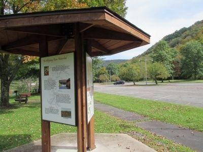
Mead in Warren County, Pennsylvania — The American Northeast (Mid-Atlantic)
The Allegheny River Watershed
Big Bend Recreation Area
— Riverside Watchable Wildlife Trail —
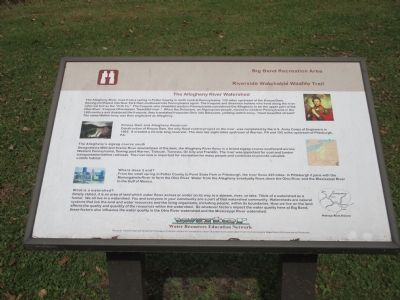
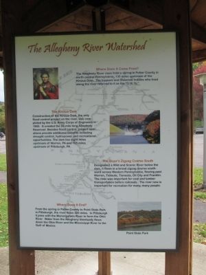
The Allegheny River rises from a spring in Potter County in north central Pennsylvania, 130 miles upstream of the Kinzua Dam, flowing northwest into New York then southwest into Pennsylvania again. The Iroquois and Shawnee Indians who lived along the river referred to it as the "O Hi Yo." The Iroquois who inhabited western Pennsylvania considered the Allegheny to be the upper part of the Ohio River. Iroquois Ohio means "beautiful river." When the Delaware, an Algonquin people, moved to western Pennsylvania in the 18th century and displaced the Iroquois, they translated Iroquoian Ohio into Delaware, yielding welhik-heny, "most beautiful stream." The name Welhik-heny was then anglicized as Allegheny.
Kinzua Dam and Allegheny Reservoir
Construction of Kinzua Dam, the only flood control project on the river, was completed by the U.S. Army Corps of Engineers in 1965. It created a 24-mile long reservoir. The dam lies eight miles upstream of Warren, PA and 195 miles upstream of Pittsburgh, PA.
The Allegheny's zigzag course south
Designated a Wild and Scenic River downstream of the dam, the Allegheny River flows in a broad zigzag course southward across Western Pennsylvania, flowing past Warren, Tidioute, Tionesta, Oil City, and Franklin. The river was important for coal and lumber transportation before railroads. The river now is important for recreation for many people and continues to provide valuable wildlife habitat.
Where does it end?
From the small spring in Potter County to Point State Park in Pittsburgh, the river flows 325 miles. In Pittsburgh it joins with the Monongahela River to form the Ohio River. Water from the Allegheny eventually flows down the Ohio River and the Mississippi River to the Gulf of Mexico.
What is a watershed?
Simply stated, it is an area of land which water flows across or under on its way to a stream, river, or lake. Think of a watershed as a funnel. We all live in a watershed. You and everyone in your community ar a part of that watershed community. Watersheds are natural systems that link the land and water resources and the living organisms, including people, within its boundaries. How we live on the land affects the quality and quantity of the resources within the watershed. So whatever factors impact the water quality here at Big Bend, these factors also influence the water quality in the Ohio River watershed and the Mississippi River watershed.
Water
Water Resources Education Network
This panel has been partially funded by the League of Women Voters of Pennsylvania Citizen Education Fund under a grant from the Pennsylvania Department of Environmental Protection.
Erected by
Water Resouces Education Network.
Topics. This historical marker is listed in these topic lists: Environment • Native Americans • Waterways & Vessels. A significant historical year for this entry is 1965.
Location. 41° 50.52′ N, 79° 0.956′ W. Marker is in Mead, Pennsylvania, in Warren County. Marker can be reached from Kinzua Road (Pennsylvania Route 59) 2 miles east of Grand Army of the Republic Highway (U.S. 6). Marker is on a walking path downstream of the easternmost parking lot entrance for the Kinzua Dam Visitor Center. Touch for map. Marker is at or near this postal address: 1205 Kinzua Road, Warren PA 16365, United States of America. Touch for directions.
Other nearby markers. At least 8 other markers are within 7 miles of this marker, measured as the crow flies. Kinzua Dam (approx. 0.6 miles away); Seneca Crossing (approx. 3.9 miles away); Conewango (approx. 6.4 miles away); Warren County (approx. 6.8 miles away); Struthers-Wetmore-Schimmelfeng House (approx. 6.8 miles away); Struthers Library Building (approx. 6.8 miles away); Warren Suspension Bridge (approx. 6.9 miles away); Soldiers' and Sailors' Monument (approx. 6.9 miles away).
More about this marker. This marker has an almost identical twin alongside the parking lot nearer to the visitors center.

via US Army Corps of Engineers, unknown
6. Kinzua Dam & Allegheny Reservoir
US Army Corps of Engineers
Pittsburgh District website entry
Click for more information.
Click for more information.
Credits. This page was last revised on January 5, 2022. It was originally submitted on October 10, 2014, by Anton Schwarzmueller of Wilson, New York. This page has been viewed 555 times since then and 32 times this year. Photos: 1, 2, 3, 4, 5. submitted on October 10, 2014, by Anton Schwarzmueller of Wilson, New York. 6. submitted on January 5, 2022, by Larry Gertner of New York, New York. • Bill Pfingsten was the editor who published this page.
