Mount Vernon near Alexandria in Fairfax County, Virginia — The American South (Mid-Atlantic)
In Memory of the Many Faithful Colored Servants of the Washington Family
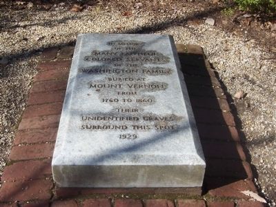
Photographed by Richard E. Miller, February 18, 2008
1. Colored Servants Memorial (1929)
Erected 1929 by the Mount Vernon Ladies Society.
Topics and series. This historical marker is listed in these topic lists: African Americans • Cemeteries & Burial Sites • Colonial Era. In addition, it is included in the Former U.S. Presidents: #01 George Washington series list. A significant historical year for this entry is 1760.
Location. 38° 42.364′ N, 77° 5.346′ W. Marker is near Alexandria, Virginia, in Fairfax County. It is in Mount Vernon. It can be reached from Mount Vernon Memorial Highway. The memorial marker is approximately 18 miles south of Washington, D.C., on the grounds of "George Washington's Mount Vernon Estate and Gardens" whose main entrance is at the intersection of the George Washington Memorial Parkway and Mount Vernon Memorial Highway (VA 235). An entrance fee is required. Touch for map. Marker is at or near this postal address: 3200 Mount Vernon Memorial Highway, Alexandria VA 22309, United States of America. Touch for directions.

Regionally, this marker is in the Washington Metropolitan Area and
this page online
Other nearby markers. At least 8 other markers are within walking distance of this marker: Mount Vernon's Slave Memorial (here, next to this marker); Slave Cemetery (here, next to this marker); Who Lies Buried Here? (a few steps from this marker); Slave Memorial (within shouting distance of this marker); Slavery at Mount Vernon (within shouting distance of this marker); Archaeology of the African-American Burial Ground (within shouting distance of this marker); African-American Burial Ground (within shouting distance of this marker); a different marker also named Slavery at Mount Vernon (within shouting distance of this marker). Touch for a list and map of all markers
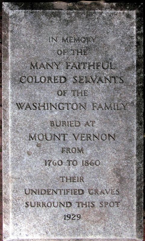
Photographed by Allen C. Browne, November 5, 2011
2. In Memory of the Many Faithful Colored Servants Marker
More about this marker. The marker is accessible via foot trails and is located in a wooded area about 0.3 miles from the estate's entrance, approximately 150 feet south of General Washington's tomb. It is adjacent to a more elaborate, upright monument to the estate's "Afro-American slaves" that was dedicated in 1983.
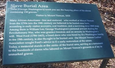
Photographed by Richard E. Miller, February 18, 2008
3. Slave Burial Area
Interpretive signage near marker.
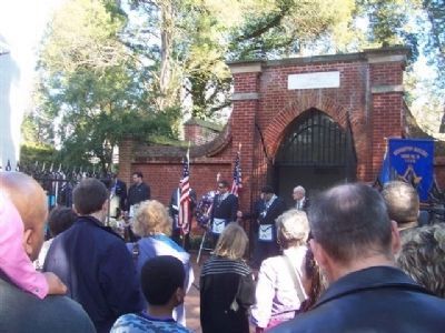
Photographed by Richard E. Miller, February 18, 2008
4. The Washington Family Tomb, north of the slave burial ground.
A Masonic ceremony in progress in commemoration of General Washington's birthday.
Photographed by Richard E. Miller, February 18, 2008
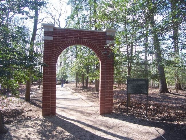
5. Entrance to Slave Burial Ground
Photographed by Richard E. Miller, February 18, 2008
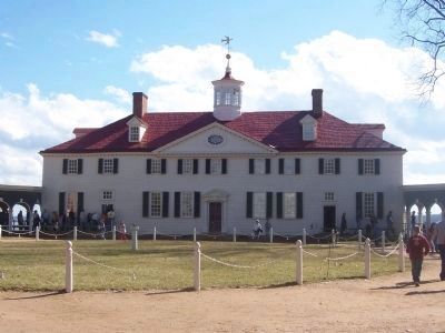
6. Mansion House
Photographed by Richard E. Miller, February 18, 2008
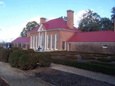
7. Greenhouse (reconstructed in 1951)
Photographed by Richard E. Miller, February 18, 2008
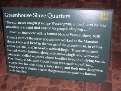
8. Greenhouse Slave Quarters
Interpretive signage.
Photographed by Richard E. Miller, February 18, 2008
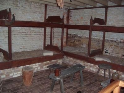
9. Greenhouse Slave Quarters
Transient barracks configuration.
Credits. This page was last revised on January 27, 2023. It was originally submitted on May 21, 2008, by Richard E. Miller of Oxon Hill, Maryland. This page has been viewed 2,081 times since then and 21 times this year. Photos: 1. submitted on May 21, 2008, by Richard E. Miller of Oxon Hill, Maryland. 2. submitted on January 14, 2018, by Allen C. Browne of Silver Spring, Maryland. 3, 4, 5. submitted on May 21, 2008, by Richard E. Miller of Oxon Hill, Maryland. 6, 7, 8, 9. submitted on May 22, 2008, by Richard E. Miller of Oxon Hill, Maryland. • Christopher Busta-Peck was the editor who published this page.
