Malvern in Carroll County, Ohio — The American Midwest (Great Lakes)
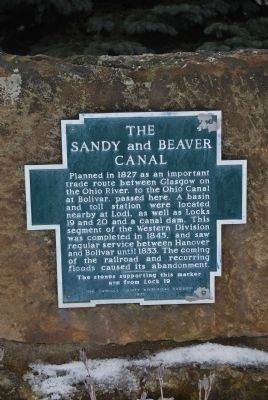
The Sandy and Beaver Canal
Planned in 1827 as an important trade route between Glasgow on the Ohio River, to the Ohio Canal at Bolivar, passed here. A basin and toll station were located nearby at Lodi, as well as Locks 19 and 20 and a canal dam. This segment of the Western Division was completed in 1845, and saw regular service between Hanover and Bolivar until 1853. The coming of the railroad and recurring floods caused its abandonment.
The stones supporting this marker are from Lock 19
Erected 1970 by The Carroll County Historical Society.
Topics. This historical marker is listed in these topic lists: Man-Made Features • Waterways & Vessels. A significant historical year for this entry is 1827.
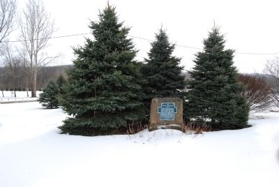
Location. 40° 41.464′ N, 81° 11.186′ W. Marker is in Malvern, Ohio, in Carroll County. Marker can be reached from West Canal Street (Route 183). Marker is located in Village Park in Malvern near the Veterans Memorial. Touch for map. Marker is in this post office area: Malvern OH 44644, United States of America. Touch for directions.
Other nearby markers. At least 8 other markers are within 4 miles of this marker, measured as the crow flies. Malvern Veteran's Memorial (a few steps from this marker); Malvern Vietnam War Memorial (within shouting distance of this marker); The Great Trail / The Ohio Country in the Revolution (within shouting distance of this marker); Theodore Newton Vail (approx. 0.3 miles away); a different marker also named Malvern Veterans Memorial (approx. 0.4 miles away); Bethlehem Cemetery Civil War Memorial (approx. 1.4 miles away); The Great Trail (approx. 3.4 miles away); Charles E. Wilson (approx. 4.1 miles away). Touch for a list and map of all markers in Malvern.
Also see . . .
1. The Gard and Vodrey Sandy and Beaver Canal maps. The American Canal Society blog entry (Submitted on April 17, 2022, by Larry Gertner of New York, New York.)
2. Sandy and Beaver Canal. Wikipedia entry (Submitted on April 17, 2022, by Larry Gertner of New York, New York.)
Credits. This page was last revised on April 17, 2022. It was originally submitted on February 8, 2015, by Mike Wintermantel of Pittsburgh, Pennsylvania. This page has been viewed 561 times since then and 34 times this year. Photos: 1, 2. submitted on February 8, 2015, by Mike Wintermantel of Pittsburgh, Pennsylvania.

