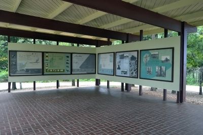
Near Ackerman in Choctaw County, Mississippi — The American South (East South Central)
The Great Eastern Hardwood Forest
(Marker #1)
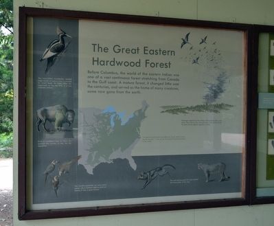
The Great Eastern Hardwood Forest
Before Columbus, the world of the eastern Indian was one of a vast continuous forest stretching from Canada to the Gulf coast. A mature forest, it changed little over the centuries, and served as the home of many creatures, some now gone from the earth.
(Drawing Captions)
Passenger pigeons by the millions darkened the skies overhead. They fed on the nuts and other fruits of the forest. The last survivor died in captivity in 1914.
“A squirrel could travel from Maine to Texas without touching the ground.” It was by far the greatest hardwood forest in the world.
The ivory-billed woodpecker needed large stands of mature trees to provide its insect food. As these have disappeared, so has the bird. It is now probably extinct.
Even a woodland type of bison frequented this country. It, too, has disappeared.
The Carolina parakeet, our only native parrot, was a common sight to early explorers. It also is gone forever.
The wolf and mountain lion once roamed the forest paths of this area.
(Marker #2)
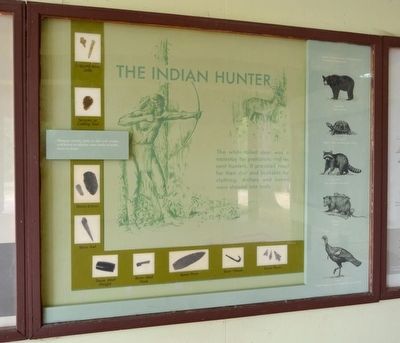
The Indian Hunter
The white-tailed deer was a mainstay for prehistoric and recent hunters. It provided meat for their diet and buckskin for clothing. Antlers and bones were shaped into tools.
Weapon points, tools to skin and scrape, and knives to butcher were made of antler, stone or bone.
(Marker #3)
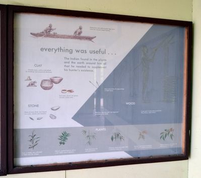
everything was useful ...
The Indian found in the plants and the earth around him all that he needed to supplement his hunter’s existence.
(Drawing Captions)
Baldcypress and yellow-poplar logs, when hollowed, became dugout canoes.
CLAY
... became pipes, pottery, and plaster for dwellings and ceremonial structures.
Red acher, mixed with grease, became a body paint.
STONE
Stone of many kinds was shaped into tools, utensils, and weapons.
WOOD
Bows were made of osage orange or black locust.
Blackhaw viburnum and “red dogwood” provided arrow shafts.
It was used to frame bark-covered huts. (Pine, hickory, black locust.)
PLANTS Corn, a staple, was cultivated in fields near the villages.
Walnuts supplied food as well as a dye widely used in basketry.
Cane was woven into mats and baskets.
Chickasaw plums were eaten fresh, or dried for winter use.
The bark and leaves of sassafras were used in medical concoctions.
Dried persimmons were made into cakes or bricks of “bread.”
(Marker #4)
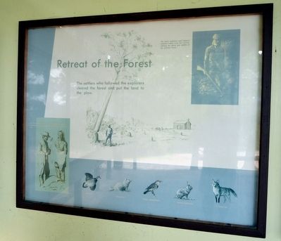
Retreat of the Forest
The settlers who followed the explorers cleared the forest and put the land to the plow.
(Drawing Captions)
The early explorers and trappers adopted Indian ways for survival, utilizing the plants and wildlife of the primitive forest.
(Marker #5)
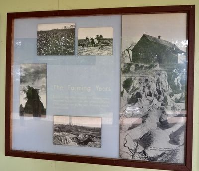
The Farming Years
Some of the areas cleared for farming were unsuited to agriculture and others suffered from unwise use of the soil. Farming slowly deteriorated.
(Photo Captions)
The major crops – corn, cotton and tobacco – grown year after year in the same field depleted the soil.
Heavy erosion of the soil helped ruin many farms.
As farms were abandoned, nature reached out eagerly to reclaim her own.
(Marker #6)
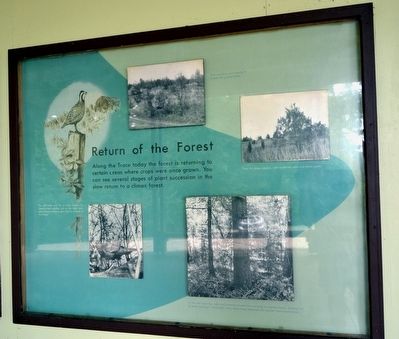
Return of the Forest
Along the Trace today the forest is returning to certain areas where crops were once grown. You can see several stages of plant succession in the slow return to a climax forest.
(Photo Captions)
First sassafras and sweetgum invade the grassy areas.
Then the pines appear, with scattered oaks and black gums.
As the soil improves, oaks and hickories invade the maturing evergreen forest, shading out all pine seedlings. Eventually, then, these trees dominate the eastern hardwood forest.
The old fields are, for a while, havens for open-country wildlife, but as the trees reappear, these creatures give way to animals of the forest.
Erected by National Park Service.
Topics and series. This historical marker is listed in these topic lists: Agriculture • Environment • Native Americans. In addition, it is included in the Natchez Trace series list. A significant historical year for this entry is 1914.
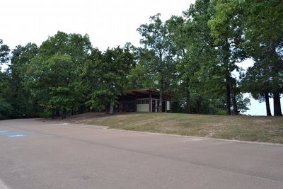
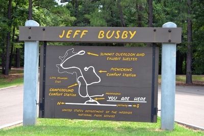
Location. 33° 24.809′ N, 89° 15.666′ W. Marker is near Ackerman, Mississippi, in Choctaw County. Marker can be reached from Natchez Trace Parkway (at milepost 193.1), 2.4 miles south of Mississippi Highway 9. Marker is in Jeff Busby Park at the end of the 0.9 mile turnoff access road from the parkway to the top of Little Mountain; the above directions are to the parkway entrance to Jeff Busby Park. Touch for map. Marker is in this post office area: Ackerman MS 39735, United States of America. Touch for directions.
Other nearby markers. At least 8 other markers are within 9 miles of this marker, measured as the crow flies. Jeff Busby Park (a few steps from this marker); The Old Natchez Trace (approx. 5.4 miles away); Old Lebanon Presbyterian Church and Campground (approx. 6.2 miles away); South Union Church and Camp Meeting (approx. 6.3 miles away); South Union Church Campmeeting (approx. 6.3 miles away); Coleman's Mill (approx. 8.4 miles away); Ackerman (approx. 8.6 miles away); Choctaw County High School (approx. 8.7 miles away). Touch for a list and map of all markers in Ackerman.
Also see . . . Natchez Trace Parkway. Official National Park Service website. (Submitted on August 21, 2015.)
Credits. This page was last revised on June 16, 2016. It was originally submitted on August 21, 2015, by Duane Hall of Abilene, Texas. This page has been viewed 629 times since then and 40 times this year. Photos: 1, 2, 3, 4, 5, 6, 7, 8, 9. submitted on August 21, 2015, by Duane Hall of Abilene, Texas.
