Near Manassas in Prince William County, Virginia — The American South (Mid-Atlantic)
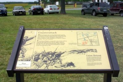
Counterattack
First Battle of Manassas
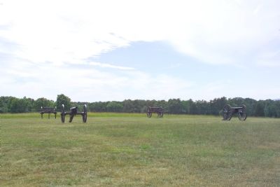
From here to Ricketts’ cannon (the start of the walking tour) the fighting fell into a bloody, seesaw pattern: Confederates capturing the line or artillery, Federals driving them off, then reinforcements again charging the guns. Late in the afternoon Confederates finally seized and held Henry Hill.
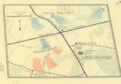
Union Retreat. The battle was decided on Henry Hill but ended on Chinn Ridge (the rising ground to the left). From here fresh Confederate brigades crossed Sudley Road and overwhelmed the Union right flank. An exhibit there depicts that final assault.
Thirteen months later, these armies fought over the same terrain. Check the park folder for the auto tour of Second Manassas.
Topics. This historical marker is listed in this topic list: War, US Civil.
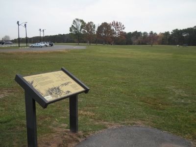
Location. This marker has been replaced by another marker nearby. 38° 48.719′ N, 77° 31.301′ W. Marker is near Manassas, Virginia, in Prince William County. Marker can be reached from Sudley Road (Virginia Route 234) 0.6 miles south of Lee Highway (U.S. 29), on the right when traveling north. The marker is one of the waysides along the Henry House Hill trail, which starts at the Manassas National Battlefield Park visitor center. Touch for map. Marker is in this post office area: Manassas VA 20109, United States of America. Touch for directions.
Other nearby markers. At least 10 other markers are within walking distance of this location. Defeat and Disarray (here, next to this marker); Final Struggle (here, next to this marker); Point Blank Volley (about 300 feet away, measured in a direct line); Point-Blank Volley (about 300 feet away); Colonel Thomas (about 500 feet away); Henry Hill (about 500 feet away); Lieutenant William P. Mangum
(about 600 feet away); Artillery Duel (about 700 feet away); General Barnard Elliott Bee (about 700 feet away); Position 7th G.A. Regt. (about 700 feet away). Touch for a list and map of all markers in Manassas.
More about this marker. This marker was replaced by a new one named Final Struggle (see nearby markers).
Additional keywords. First Battle of Bull Run. 1st Bull Run. 1st Manassas. Ricketts’ cannon, Rickett's cannon, Ricketts' cannon, Captain J. B. Ricketts, Battery D, 5th U.S. Artillery, commanded by Capt. Charles Griffin. Confederate Col. Arthur C. Cummings, 33rd Virginia Infantry.
Credits. This page was last revised on July 14, 2019. It was originally submitted on March 18, 2007, by Tom Fuchs of Greenbelt, Maryland. This page has been viewed 1,852 times since then and 18 times this year. Photos: 1, 2. submitted on March 18, 2007, by Tom Fuchs of Greenbelt, Maryland. 3. submitted on November 25, 2010, by Bill Coughlin of Woodland Park, New Jersey. 4. submitted on March 18, 2007, by Tom Fuchs of Greenbelt, Maryland. • J. J. Prats was the editor who published this page.


