Green Acres in Palo Alto in Santa Clara County, California — The American West (Pacific Coastal)
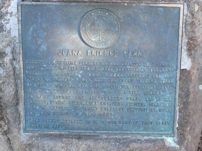
Juana Briones Park
This park, dedicated in 1989, was part of that early Spanish life.
Erected 1989 by City of Palo Alto.
Topics. This historical marker is listed in these topic lists: Hispanic Americans • Native Americans • Settlements & Settlers • Women. A significant historical date for this entry is June 30, 1840.
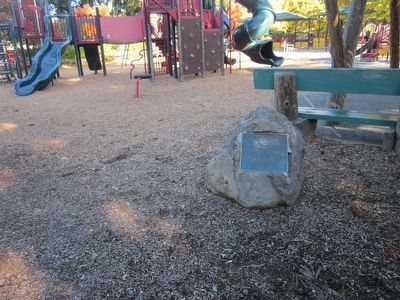
Location. 37° 24.471′ N, 122° 7.644′ W. Marker is in Palo Alto, California, in Santa Clara County. It is in Green Acres. Marker can be reached from Maybell Avenue just west of Clemo Avenue, on the right when traveling east. The marker is located near the northeast corner of the park behind the train play structure. Touch for map. Marker is at or near this postal address: 609 Maybell Avenue, Palo Alto CA 94306, United States of America. Touch for directions.
Other nearby markers. At least 8 other markers are within 2 miles of this marker, measured as the crow flies. Juana Briones. This is her park. (here, next to this marker); Mayfield Fire Bell (about 500 feet away, measured in a direct line); Homesite of Sarah Wallis (approx. 0.6 miles away); Birthplace of Silicon Valley (approx. 0.9 miles away); El Palo Nuevo (approx. 1.1 miles away); J. Pearce Mitchell Park (approx. 1.2 miles away); Site of Juana Briones de Miranda Home on Rancho La Purisima Concepcion (approx. 1.3 miles away); Play Ball! (approx. 1.4 miles away). Touch for a list and map of all markers in Palo Alto.
Also see . . . Juana Briones. The National Park Service - The Presidio Brochure gives a short description of Juana Briones and her life in the Bay Area. (Submitted on November 20, 2015.)
Credits. This page was last revised on February 7, 2023. It was originally submitted on November 20, 2015, by Syd Whittle of Mesa, Arizona. This page has been viewed 457 times since then and 24 times this year. Photos: 1, 2. submitted on November 20, 2015, by Syd Whittle of Mesa, Arizona.

