On Congress Street at North Street, on the right when traveling north on Congress Street.
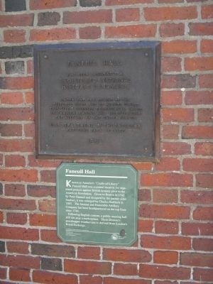
Known as America’s “Cradle of Liberty” Faneuil Hall was a central location for organized protests against British tyranny prior to the American Revolution. Given to Boston in 1742 by Peter Faneuil and designed by the painter John Smibert, it was . . . — — Map (db m18067) HM
Near Congress Street at North Street, on the right when traveling north.
This is Faneuil Hall the Cradle of Liberty built and given to the town of Boston by Peter Faneuil ***** 1742 ***** Still used by a free people 1930 — — Map (db m18088) HM
On Marshall Street at Creek Sq, on the right when traveling north on Marshall Street.
Near this spot the Green Dragon Tavern The secret meeting place of the Sons of Liberty and in the words of Webster the Headquarters of the Revolution To mark a site forever memorable as The birthplace of American Freedom This Tavern is . . . — — Map (db m18091) HM
On State Street at Washington Street, on the right when traveling west on State Street.
The Walk to the Sea encompasses four centuries of Boston history. Beginning at the State House on Beacon Hill, overlooking Boston's ancient Common, the Walk passes among historic landmarks and skyscrapers. The Walk crosses ground that centuries . . . — — Map (db m234424) HM
Near Salem Court at Salem Street, on the left when traveling east.
The first steeple was the one that Paul Revere knew as a boy (and bellringer) and later incorporated into his lantern signal plan. Because of the spire's height, any light shining from the topmost windows would be visible to Revere's fellow riders . . . — — Map (db m234430) HM
Near Salem Court at Salem Street, on the left when traveling east.
The second spire lasted until August 1954 when Hurricane Carol pummeled Boston. Spectators anxiously watched the spire teeter and sway until finally it fell across Salem Street and into Hull Street. The only damage was a small chunk dislodged from . . . — — Map (db m234432) HM
Near Salem Court at Salem Street, on the left when traveling east.
"As the family story goes, while some of the locals took bits and pieces of the steeple as souvenirs, my uncle absconded with [a piece of] the weathervane and convinced my dad to hide it in our apartment. Supposedly they stashed it in my bedroom. . . . — — Map (db m234433) HM
On Hanover Street near Prince Street, on the right when traveling north.
The challenge of building the Florentine Café was given to Bradford Construction Company by the Riccio Family in 1995. A demanding task since the family wanted to keep the old original look of the late 1800's. To do this Bradford Construction . . . — — Map (db m234440) HM
Near Salem Court at Unity Street, on the left when traveling west.
How does a house tell the story of a changing neighborhood?
Built ca. 1712-1715, this sturdy brick house became home to its builder, Ebenezer Clough, the master mason who helped construct Old North Church. He built several similar houses on . . . — — Map (db m234439) HM
This graceful home was built around 1712 and managed to survive when all its neighbors--including the house that Ben Franklin owned next door--were torn down. This was the home of one of Boston's "substantial mechanicks," Ebenezer Clough, the . . . — — Map (db m76630) HM
On North Square, on the left when traveling north.
Moses Pierce-Hichborn House has been designated a Registered National Historic Landmark Under the provisions of the Historic Sites Act of August 21, 1935 this site possesses exceptional value in commemorating or illustrating the history of the . . . — — Map (db m18069) HM
Near North Square, on the left when traveling north.
This courtyard is the site of the Barnard House, built at the same time as the Revere House as part of a row of three similar wooden dwellings. The three houses were built after the great fire of November, 1676, had ravaged the neighborhood. . . . — — Map (db m19273) HM
On North Square, on the left when traveling north.
Paul Revere House has been designated a Registered National Historic Landmark Under the provisions of the Historic Sites Act of August 21, 1935 this site possesses exceptional value in commemorating or illustrating the history of the United . . . — — Map (db m18068) HM
On North Square at North Street, on the right when traveling north on North Square.
“Messenger of the Revolution”
“Patriot Engraver”
“Pioneer Industrialist”
These are among history’s labels for Paul Revere, who occupied this small frame house on North Square from 1770 to 1800. Built about 1676 after one of the great . . . — — Map (db m21543) HM
Near Salem Court at Salem Street, on the left when traveling east.
For Old North's first 17 years (1723-1740), there was no wooden spire on top of the brick tower. Imagine how different it must have looked! In 1737, church leaders began a subscription campaign to collect money to fund the construction of the . . . — — Map (db m234428) HM
Near Salem Court at Salem Street, on the left when traveling east.
In October of 1804, Boston was struck by a 'very violent gale' that blew the wooden spire from Old North's tower, destroying a house below. There was no salvaging it. Once again, church leaders appealed to members of the congregation and to . . . — — Map (db m234431) HM
Near Salem Court at Salem Street, on the left when traveling east.
Old North's iconic steeple may be one of the most memorable images along the Freedom Trail-but did you know that the steeple you see today is actually Old North's third steeple? Yes, that's right! Not once, but twice, powerful storms have blown . . . — — Map (db m234427) HM
Built c. 1680, this is the last remaining structure from 17th –century Boston. Patriot and silversmith Paul Revere owned the building from 1770 to 1800. He left this house for his famous Midnight Ride on April 18, 1775. After use as a tenement . . . — — Map (db m62587) HM
The Salutation Tavern Opened in 1662, stood on the north east corner of Salutation and North Streets adjoining this Mall It was the meeting place of The Committee of Safety and in it was planned The Boston Tea Party Here Samuel . . . — — Map (db m76625) HM
Near Salem Court at Salem Street, on the left when traveling east.
In October 1955, the third steeple, topped by Shem Drowne's weathervane, was hoisted into place and secured with steel reinforcements. This time, the steeple was a deliberate replica of the original, consciously recalling the colonial identity and . . . — — Map (db m234435) HM
Near Salem Court at Salem Street, on the left when traveling east.
Rebuilding Old North's steeple became a national project, reflecting Old North's national prominence as a symbol of freedom and of the American Revolution. Funds flowed in from across the country and from people of all ages.
Photo credit: Pete . . . — — Map (db m234434) HM
Near Salem Court at Salem Street, on the left when traveling east.
Topping the Old North steeple(s) for almost 300 years is the golden weathervane created by Shem Drowne. Drowne made some of the most iconic weathervanes of the colonial era, including the grasshopper that graces Faneuil Hall.
Photo caption: . . . — — Map (db m234429) HM
On Lynde Street north of Cambridge Street, on the left when traveling north.
Welcome to the Otis House Museum, one of thirty-five historic sites operated by Historic New England.
We invite you to explore the Otis House, the only freestanding eighteenth-century mansion surviving in downtown Boston. The museum . . . — — Map (db m215101) HM
On Shirley Street, on the right when traveling south.
In 1637 William Peirce, Captain of the ship "Lion" erected this house which was occupied from 1647 to 1703 by Deane Winthrop, younger son of Governor Winthrop. — — Map (db m48828) HM
Athol's town hall for 20 years, it stood west of the common until moved here in 1850. It alsoo served as "Athol Academy" in 1828. Then as a Congregational church in 1830-33 — — Map (db m136391) HM
On Main Street (Massachusetts Route 2A), on the right when traveling west.
Athol's town hall for 20 years. It stood west of the common until moved here in 1850. It also served as "Athol Academy" in 1828. Then as a congregational church in 1830-33. — — Map (db m138985) HM
In the early 1800's there was a square enclosure of stone walls here. Built by the town to hold stray cattle and other animals. Their owners had to pay a claim fee to the pound keeper — — Map (db m136392) HM
On Lincoln Street at Common Street, on the left when traveling east on Lincoln Street.
Banister
Memorial Hall
erected by
Wm. A. Banister
of New York
A.D. 1883
In Memory Of
James Banister died 1731
Seth Banister died 1783
Col. Seth Banister died 1819
Capt. Seth Banister died 1857
Rev. Seth Banister died . . . — — Map (db m198788) HM
On Lincoln Street at Common Street, on the left when traveling east on Lincoln Street.
This Property Has Been
Placed on the
National Register
of Historic Places
by the United States
Department of the Interior
BHC 1990 — — Map (db m198684) HM
in Leominster built 1775 taken down July 4, 1824 rebuilt for first town house This tablet presented to the town of Leominster by the Leominster Historical Society on the 175th anniversary incorporation Leominster 1915 — — Map (db m138081) HM
On Main Street near Maple Street, on the left when traveling south.
Built in 1840, this Greek Revival Style three-story building named in honor of President William Henry Harrison was constructed in partnership between the townspeople and Gentleman Farmer Silas Dudley who donated the land and design for the . . . — — Map (db m195701) HM
On Main Street (Massachusetts Route 9) at Pleasant Street (Massachusetts Route 31), on the left when traveling north on Main Street.
Built on the site of Jenk’s Tavern in 1873, it was
destroyed by fire in 1982. The tavern, where
President George Washington stayed overnight
in 1789, had burned down in 1870 — — Map (db m198340) HM
This house was built in 1796 in Charlton, Massachusetts for prosperous farmer and merchant Salem Towne and his family. Its architecture is a rural interpretation of the "Adam" or "Federal" style. Between the 1780s and the 1820s, the first . . . — — Map (db m118914) HM
On Maple Street north of Main Street, on the left when traveling north.
When Congregationalism was no longer the official religion of Massachusetts and the church could no longer also serve as the "town house", Sturbridge built its first secular Town Hall in 1838. Twenty years later, the town permitted the Worcester . . . — — Map (db m209736) HM
On N Main Street at Court Street, on the right when traveling north on N Main Street.
This house was built in 1768
by
Simeon Wheelock 1st Lieut.,
in the Revolutionary War
and
Deborah his wife
Presented to the
Deborah Wheelock Chapter
Daughters of the American Revolution
In 1910 by
Mr. & Mrs. William E. Hayward. . . . — — Map (db m191715) HM
On Grove Street at Salisbury Street (Local Route .01) on Grove Street.
A few rods east stood the house and mill of John Wing built in 1684. This was the only house left standing after the breaking of the second settlement of Worcester. — — Map (db m48044) HM
138 entries matched your criteria. Entries 101 through 138 are listed above. ⊲ Previous 100