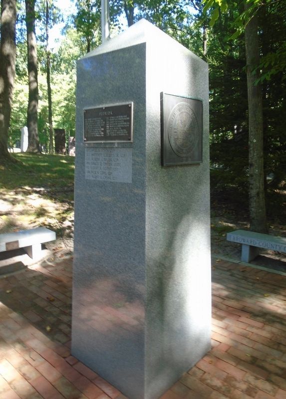
PFC Emory L. Bennett, USA • SP4 Nicholas J. Cutinha, USA
LCDR William M. Corry, Jr., USN • 2Lt Robert E. Femoyer, USAF
CAPT Robert H. Foley, US[A] • PFC Robert H. Jenkins, USMC
LT Clyde E. Lassen, USN • 1Lt Baldomero Lopez, USMC
CDR . . . — — Map (db m235314) WM
Floyd L. and Jane Wray founded Flamingo Gardens, originally Flamingo Groves, in 1927. It first served as a citrus grove, and later became a botanical garden. The Wrays built this frame house in 1933 as a weekend home, and used it for relaxing and . . . — — Map (db m271859) HM
Rivermont is an archaeological site part of what was once a large prehistoric site complex located on the north bank of the New River, within the Sailboat Bend Historic District. Once a thriving Tequesta village and ceremonial complex, this site . . . — — Map (db m250561) HM
The settlement of Deerfield was founded on the southeast coast of Florida with the coming of Henry Flagler’s Florida East Coast Railroad in 1896. In 1902, two Methodist missionaries began holding religious services for the community. These early . . . — — Map (db m100392) HM
African Americans living in South Florida in the early part of the 20th century drove from as far away as Palm Beach and Miami to use Fort Lauderdale’s beaches but met with significant resistance from oceanfront property owners. On May 14, 1946, a . . . — — Map (db m272248) HM
This historic structure was the first permanent school in the Everglades and is now Broward County’s oldest existing school building. The Davie School was designed in 1917 by August Geiger (born 1888), who came to Miami in 1905 from New Haven, . . . — — Map (db m41666) HM
Coming over from the Bahamas sometime before 1792, Suries and Frankee Lewis and their three sons settled on the banks of the New River and were the first permanent settlers of European descent in what is now Broward County. In 1793, after reports . . . — — Map (db m63656) HM
Side 1
The Margate Blount Site was known as early as 1940. Parkland Founder Bruce Blount observed what appeared to be a wooden crypt filled with skeletal remains when in 1959 a bulldozer struck the mound and scattered bones. The remains were . . . — — Map (db m249972) HM
African Americans living in South Florida in the earlier part of the 20th century drove from as far away as Palm Beach and Miami to use Fort Lauderdale’s beaches, but met with significant resistance from oceanfront property owners. On May 14, 1946, . . . — — Map (db m127513) HM
In 1906, Deerfield Beach established Colored School #9 to educate African American children prevented from attending white-only schools in Broward County. A one-room, wooden structure located near NW 1st Avenue, it was destroyed in the Hurricane of . . . — — Map (db m271785) HM
Old Fort Lauderdale Village at the intersection of the New River and the Florida East Coast Railway (F.E.C.) incorporates four turn-of-the-20th century historic buildings. These include the 1905 New River Inn, the 1905 Philemon N. Bryan House, the . . . — — Map (db m63880) HM
The recreation area encompassed by Colony Club Road, during World War II (1941-1945), was the site of the corrals and paddocks for the United States Coast Guard’s Silver Thatch Mounted Beach Patrol. The mounted beach patrol protected the coast from . . . — — Map (db m127514) HM
Naval Air Station Fort Lauderdale (NASFL), a complex of over 200 buildings, was built on the site of Merle Fogg Field in 1942 and served as one of a few specialty schools for training on the TBF/TBM Avenger torpedo bomber. Nineteen-year-old pilot . . . — — Map (db m100393) HM
Early residents of the Parkland area have been aware of the Margate Blount site since 1940. In 1959, a bulldozer struck the mound and scattered bones. Since neither Parkland nor Coral Springs existed the site was jointly named for the adjacent . . . — — Map (db m253376) HM
(Side 1)
The first school for Pompano Beach’s African American students was a two-room wooden building that was destroyed in the 1926 Great Miami hurricane. Classes were held in the Psalters Temple AME Church until a new schoolhouse could . . . — — Map (db m137400) HM
Thin black lines indicate changes in relevance. Between each pair of lines entries are ordered geographically but all have the same relevance.
* Inflectional forms of words are their plurals, singulars, and possessives as well as gramatical tenses and similar variations.