"The last crop of the old field had been corn and among its stubble that day were sown the seeds of glory." Morris Schaff, USA Staff Tucked away in the Wilderness's trackless forest were several small clearings, where families with names . . . — — Map (db m155690) HM
In this field and its surrounding woods fell nearly one-third of the men killed or wounded in the Battle of the Wilderness. The two-mile Gordon Flank Attack Trail tracks the Battle of the Wilderness in all its horrible forms: the open-field Union . . . — — Map (db m7378) HM
"The regiment melted away like snow. Men disappeared as if the earth had swallowed them." -Captain Porter Parley 140th New York Infantry Shortly after noon on May 5, the battleline of the 140th New York burst from the woods to your right-rear . . . — — Map (db m6022) HM
Confederate troops commanded by General Richard S. Ewell arrived on this ridge line on the morning of May 5. Ordered by General Lee not to initiate a battle, Ewell placed 10,000 men along this high ground on either side of the Orange Turnpike . . . — — Map (db m155698) HM
The road trace in front of you is the Culpeper Mine Road, typical of the woods trails that composed the primitive transportation network in the Wilderness. Even a path like this possessed military significance, and Confederate troops from the famous . . . — — Map (db m7380) HM
Confederate General Leroy A. Stafford of Louisiana fell mortally wounded in this vicinity during the afternoon fighting. General Ewell, however, continued to reinforce this line, extending it farther to the north, your left. When the Federals . . . — — Map (db m7382) HM
On the morning of May 6, the main focus of the battle shifted more than two miles south, to the Orange Plank Road. Here, north of the Orange Turnpike, both armies planned early morning attacks as diversions to prevent the enemy from detaching more . . . — — Map (db m7383) HM
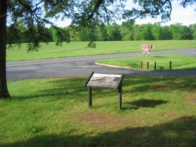
On the morning of May 6, Confederate General John B. Gordon occupied the far Confederate left, in this vicinity, with his brigade of Georgians. Gordon reconnoitered to his left and front and discovered the Union right flank to be vulnerable to an . . . — — Map (db m7384) HM
The right flank of the Union line rested here in the early evening of May 6. Two Union brigades occupied this area with the benefit of neither strong works nor substantial artillery support. Suddenly, the Rebel yell echoed through the forest. North . . . — — Map (db m7388) HM
Union reinforcements rushed to the sound of fighting as twilight turned to darkness in these gloomy woods. The Confederates lost direction and momentum in the smoky gloaming, and eventually the firing died away. Gordon's attack had achieved only a . . . — — Map (db m7389) HM
In front of you are the remains of trenches manned by the Union army on May 5-6, 1864. When Gordon attacked these works from the north, your left, the Federals abandoned them and fell back to a new position one mile to your front and right. The . . . — — Map (db m7391) HM
Collision of Giants By 1864 the war had become not just a clash of armies, but of ideas. To be resolved on the fields of Virginia and Georgia that year was not only the fate of the Union, but also the fate of Southern society. The armies on both . . . — — Map (db m6077) HM
The Armies The Army of the Potomac Throughout the winter of 1863-1864, the armies rested and refitted on opposite sides of the Rapidan River. The ranks of the Union army swelled with thousands of new draftees and recruits - soldiers whose . . . — — Map (db m155689) HM
Crisis at the Crossroads Crises followed one after another on May 5. No sooner had Grant and Meade learned about Ewell's approach on the Orange Turnpike than they discovered General A.P. Hill's corps moving up the Orange Plank road. If Hill . . . — — Map (db m7394) HM
Stalemate Two days of bitter fighting had left the bleak Wilderness landscape charred and smoking from fire. Corpses littered the contested ground, now scarred by miles of earth-and-log entrenchments. Unwilling to attack Lee's strong position, . . . — — Map (db m7397) HM