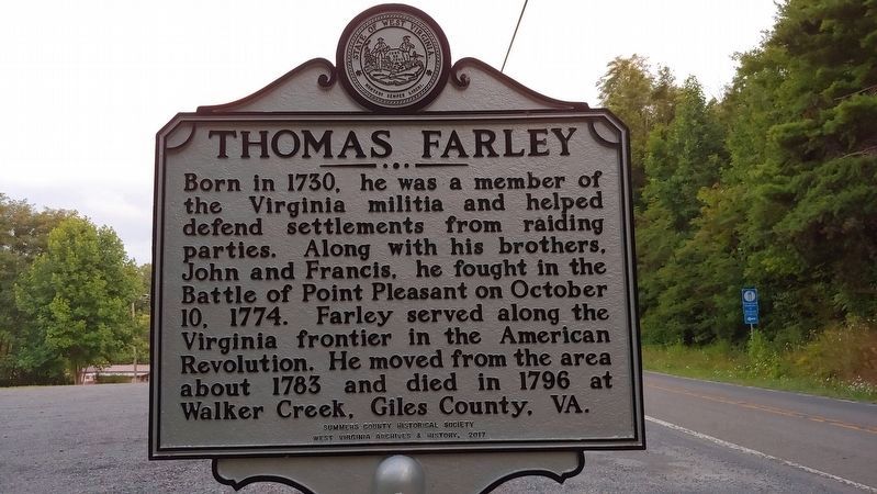
On Hinton Road (West Virginia Route 20) at Indian Ridge (County Route 26), on the right when traveling north on Hinton Road.
Farley's Fort. One of two pre-Revolutionary forts built along the banks of the New River at Culbertson's (now Crump's) Bottom to shelter area settlers. Farley's Fort was established by Thomas Farley in the mid-1770s. Virginia militia later . . . — — Map (db m140095) HM
On Pulaski Giles Highway (Virginia Route 100) at Bane Road, on the left when traveling north on Pulaski Giles Highway.
A Revolutionary War soldier, was buried near this site in 1796. His services, extending over twenty years, include:
1758 French and Indian Wars
1774 Battle of Point Pleasant
1776 Erected Farley's Fort, near the New River.
1778 Fought in . . . — — Map (db m305072) HM