THE HISTORICAL
MARKER DATABASE
“Bite-Size Bits of Local, National, and Global History”


7 entries match your criteria.  


Related Historical Markers

 
By Gordon Govier, September 5, 2009
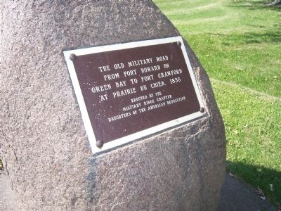
The Old Military Road Marker
SHOWN IN SOURCE-SPECIFIED ORDER
1 ► Wisconsin, Grant County, Patch Grove — The Old Military Road —
On U.S. 18 at Lawless Road, on the right when traveling west on U.S. 18.
The Old Military Road From Fort Howard on Green Bay to Fort Crawford at Prairie du Chien, 1835. — — Map (db m36005) HM
2 ► Wisconsin, Iowa County, Dodgeville — 38 — Old Military Road —
On County Highway Y at Canyon Park Road, on the right when traveling west on County Highway Y.
You are traveling the route of the Old Military Road, built in 1835-36, to connect Fort Crawford at Prairie du Chien and Fort Howard at Green Bay, via Fort Winnebago at "The Portage" between the Fox-Wisconsin rivers. The section from Prairie du . . . — — Map (db m36908) HM
3 ► Wisconsin, Dane County, Dane — 26 — Old Military Road - 100 Mile Point —
On Dunroven Road at County Road DM, on the right when traveling south on Dunroven Road.
In July, 1833, Lt. Alexander Center blazed a nearby oak, marking the 100-mile point of a military road he and James Doty were surveying. The Old Military Road, built from 1835 to 1837, connected Ft. Crawford at Prairie du Chien, Ft. Winnebago at . . . — — Map (db m36907) HM
4 ► Wisconsin, Fond du Lac County, Fond du Lac — Pioneer Military Road — 1835 —
On South Military Road at West 9th Street on South Military Road.
Fort Howard, Green Bay to Fort Crawford, Prairie du Chien — — Map (db m36004) HM
5 ► Wisconsin, Fond du Lac County, Fond du Lac — 208 — The Military Road —
On South Military Road at West 2nd Street, on the right when traveling north on South Military Road.
The Military Road, built in 1835, became the first highway to cross the state. Congress appropriated $5,000 to connect the St. Lawrence and Mississippi River basins. The troops at Fort Crawford constructed the road from Prairie du Chien to . . . — — Map (db m46182) HM
6 ► Wisconsin, Manitowoc County, Manitowoc — Old Military Road —
On North Rapids Road (County Road R) at Delta Street, on the right when traveling north on North Rapids Road.
This tablet marks the Old Military Road completed in 1840 used between Fort Howard (Green Bay) and Fort Dearborn (Chicago) — — Map (db m57240) HM
7 ► Wisconsin, Langlade County, Lily — 119 — Old Military Road —
On State Highway 55 3.7 miles north of State Highway 52 W, on the left when traveling north.
In March 1863 Abraham Lincoln signed an Act of Congress which enabled the states of Michigan and Wisconsin to begin construction of a road between Fort Howard at Green Bay and Fort Wilkins near Copper Harbor. It took one year to build the . . . — — Map (db m36896) HM
 
 
CeraNet Cloud Computing sponsors the Historical Marker Database.
This website earns income from purchases you make after using our links to Amazon.com. We appreciate your support.
Paid Advertisement
Nov. 11, 2026
