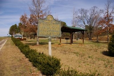
On Homer Road (U.S. 441) 0 miles north of Womack Drive, on the right when traveling north.
This line, sometimes called “The Four Mile Purchase Line” was the boundary between Georgia and the Cherokee Nation from 1804 to 1818. It was established when Georgia bought a four mile strip from the Indians so as to take in Wofford’s . . . — — Map (db m40642) HM
On Old U.S. 441 at Line Church Road, on the right when traveling south on U.S. 441.
The Line Baptist Church was constituted Sept. 13, 1802, by Rev. Moses Sanders, Thomas Maxwell and Daniel White.
This church was just over the line between Georgia and Cherokee lands. Meetings couldn’t be held at night, because all white people . . . — — Map (db m40651) HM
On Yonah-Homer Road at Historic Homer Highway (Georgia Route 51), on the left when traveling north on Yonah-Homer Road.
This eternal flame is a memorial to those American soldiers from Banks County, Georgia who gave their lives in heroic sacrifice for their country while serving on foreign soil in the wars of this century.
Henry T. Gillespie WWI •
James M. . . . — — Map (db m252494) WM
Thin black lines indicate changes in relevance. Between each pair of lines entries are ordered geographically but all have the same relevance.
* Inflectional forms of words are their plurals, singulars, and possessives as well as gramatical tenses and similar variations.