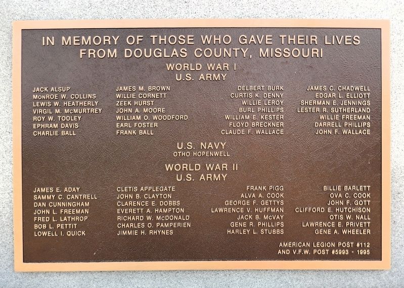
On North Jefferson Street (County Road 201) just north of East Ozark Avenue, on the right when traveling north.
[center panel]Dedicated to those who have served Veterans of All Wars Erected May 30 1964 Dedicated Nov 11 1996 Erected by the people of Douglas County Sponsored by Ava Garden Club & American Legion Post 112 . . . — — Map (db m297120) WM
On U.S. 59 at East 6th Street, on the left when traveling east on U.S. 59.
This place holds many meanings to the many peoples who have called this region home. Through the 1700s, this area was part of the Kanza (today known as the Kaw Nation) homeland where they lived, farmed, and traded in towns along the Missouri . . . — — Map (db m287468) HM
Johan Ahmanson was born on April 7, 1827, in Smaland, Sweden. At age six he was taken to live with a farmer, for whom he worked until age eighteen. He became a master bookbinder and emigrated to Denmark in 1849. There he was recruited by the . . . — — Map (db m58207) HM
On Jefferson Street (Business State Highway 5) 0.1 miles south of East Washington Avenue (State Highway 14), on the left when traveling south.
Here in the heartland of the Missouri Ozarks, Douglas County was organized in 1857 and named for statesman Stephen A. Douglas. Southern pioneers, attracted by forested hills, abundant game, spring-fed streams, fertile valleys, were first settlers . . . — — Map (db m189740) HM
On 3rd Street at Main Street (Missouri Highway U), on the left when traveling west on 3rd Street.
County of magnificent scenery, in which extend both Bull Shoals and Norfolk lakes, Ozark was organized, 1841. Briefly called Decatur, 1843-45, it is the only county in the United States named for the nation’s oldest mountainous region. The name . . . — — Map (db m140934) HM
On Massachusetts Street south of 6th Street, on the left when traveling south.
On the afternoon of September 14th, 1856, the Free State settlement of Lawrence, Kansas Territory was threatened with invasion by an army of 2700 Pro-slavery Missourians under the command of Generals David R. Atchison and John W. Reid. Encamping . . . — — Map (db m76325) HM
On Main Street at 9th Street, on the left when traveling north on Main Street.
Shawnee Tribal Leader Paschal Fish and his daughter, Eudora
This statue has been created to commemorate the 150th anniversary of the City of Eudora (1857-2007). The statue portrays Shawnee Tribal Leader Paschal Fish and his daughter, . . . — — Map (db m239853) HM
On Main Street at 3rd Street, on the right when traveling south on Main Street.
This is the oldest surviving courthouse designed by George P Washburn of Ottawa. Before coming to town, Washburn had worked for the Kansas City architectural firm of Cross and Taylor where he supervised construction of Union railroad depots . . . — — Map (db m67586) HM
On Riverfront Drive, on the left when traveling south.
This Union Walk is a reminder to all of our citizens, as well as a salute to the unionized men and women from all walks of life, who invested their energy, the sweat of their brow, and sometimes even their lives to forge a better life for . . . — — Map (db m63498) HM
Thin black lines indicate changes in relevance. Between each pair of lines entries are ordered geographically but all have the same relevance.
* Inflectional forms of words are their plurals, singulars, and possessives as well as gramatical tenses and similar variations.