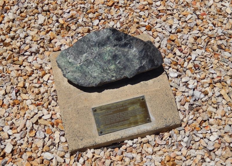
Near South Bridge Street just north of West Fifth Street, on the right when traveling north.
Dedicated on the Pilgrimage to ‘Mucca on 3 Rabia I, 1380 A.H. (Mohammedan Calendar). Brought by caravan from the sea at Crescent City, California, to dedicate the opening of the new trade route from Winnemucca to the sea and to affirm the . . . — — Map (db m170925) HM
On Mill Creek Drive near Shoreline Highway (California Route 1).
The clatter of lumber and the shouts of longshoremen at Laguna Point began in 1883. Schooners and steamships moored here to take on loads of Mendocino's valuable redwood lumber
Laguna Point
In 1883, the Laguna Point loading operation . . . — — Map (db m96629) HM
On Railroad Avenue at F Street when traveling north on Railroad Avenue.
Incorporated December 15, 1854, as the Union Plank Walk, Rail Track, and Wharf Company, the Arcata and Mad River Rail Road is the oldest line on the north coast. Originally using a horse-drawn car, the railroad served as a link between Humboldt Bay . . . — — Map (db m113364) HM
Indigenous People
Since time immemorial, Lalongkok peoples have lived respectfully among and cared for these redwoods. As Europeans arrived, their cultural ideology led to lasting negative impacts to native cultural practices and to . . . — — Map (db m190829) HM
In Memory of
Co. E & I 2nd. California Volunteer Infantry 1862 - 1863
Co. B 1st. Battalion Mountaineers California Volunteers 1863 - 1864
Co. A. 1st Battalion Native California Volunteer Calvary 1864
and
Marie Brizard Todd, . . . — — Map (db m32567) HM
On Lankershim Boulevard at Hartsook Street, on the right when traveling north on Lankershim Boulevard.
Celebrities Sat for His Camera
Back when the fields of the San Fernando Valley helped to feed California and eventually the nation, Fred Hartsook raised champion black and white Holstein dairy cows with names like Bessie, Snowball, . . . — — Map (db m189206) HM
On Cookhouse Road, on the right when traveling north.
Inside you will interact with stories of the past, discover local culture, and view unique maritime artifacts
A group of local seafarers established the Humboldt Bay Maritime Museum in 1977 so residents and visitors could experience the . . . — — Map (db m81831) HM
On F Street at Route 101, on the left when traveling south on F Street.
Here, on the block of land bounded by E, F, 4th, and 5th streets, over 300 Chinese people once lived in a bustling Chinatown. But high unemployment, economic uncertainty, and a perceived competition for jobs served as excuses for anti-Chinese hate. . . . — — Map (db m233370) HM
On Museum Avenue near Maple Avenue, on the left when traveling west.
In 1868 the Central Pacific Railroad (CPR) was completed from Sacramento to Winnemucca and the first locomotive, the Champion, traveled to Winnemucca. On May 10, 1869 the CPR and the Union Pacific Railroad (UPR) were joined at Promontory, Utah. On . . . — — Map (db m141451) HM
Near Highway 101 at S Broadway Street, on the right when traveling north.
Hal, a native of San Diego, was graduated from San Diego State College with a degree in Civil Engineering, and subsequently started work with the California Division of Highways in that area.
As a person dedicated to serving the needs of . . . — — Map (db m1556) HM
The Berding House, also known as the Gumdrop Tree House, was built by pioneer merchant Arnold Berding in 1875. Berding owned the first general store in Ferndale. The gumdrop trees are coast cypress which were planted in 1865 and have always been . . . — — Map (db m231397) HM
On 9th Street at O Street, on the right when traveling south on 9th Street.
Gushaw-Mudgett House
circa 1884
commonly known as the Mudgett house
It was built the mid 1880's, when Italianate architecture was popular in Humboldt County. Eastlake detail is also evident. The main portion of the
house was . . . — — Map (db m316268) HM
On First Street north of East B Street, on the left when traveling south.
In the early Twentieth century, Benicia supplied one-third of California's leather, much of it tanned on this site by Kullman, Salz & Company. Beginning in 1881, early tannery structures occupied the western half of this block and by 1891 tannery . . . — — Map (db m40834) HM
Near Central Avenue at Western Avenue, on the right when traveling south.
Here was a key point on Nevada's earliest road, the famed Humboldt Trail that brought 165,000 imigrants west in the 1840's and 50's. Travelers named this rich valley the Big Meadows and stopped for water and grass before continuing south to cross . . . — — Map (db m67898) HM
On G Street at Laura Lane, on the right when traveling south on G Street.
Richard Sweasey originally financed the construction of this theater which displays his name. Mr. Sweasey was a businessman in the early days of Eureka. Sweasey served as a member of the California State Legislature and several terms as a Humboldt . . . — — Map (db m71971) HM
Near Highway 101 at S Broadway Street, on the right when traveling north.
Captain Jonathan Winship made the first recorded entry into Humboldt Bay by sea in June 1806. Encountered in 1849 by Josiah Gregg’s party. New word of its existence reached San Francisco. By 1850 the Laura Virginia Association had founded Humboldt . . . — — Map (db m1555) HM
On Edwards Street at Ocean Avenue, on the right when traveling north on Edwards Street.
Directly below was located the ancient Yurok village of Tsurai. A prehistoric, permanent Indian community, it was first located and described by Captains Bodega and Heceta, June 9-19, 1775. The houses were of hand-split redwood planks, designed for . . . — — Map (db m1189) HM
On Baud Street at East 5th Street, on the right when traveling north on Baud Street.
The oldest known masonic document, the Halliwell Manuscript (or Regius Poem), dates to around 1390 and hints at the craft's ancient roots. freemasonry stands as the world's oldest and largest fraternal order. On june 24, 1717, the Grand Lodge of . . . — — Map (db m283954) HM
On E. 2nd Street (Nevada Route 289) south of See Drive, on the right when traveling east.
The Humboldt Canal, sometimes termed the Old French Canal, coursed southwestward from Preble, near Golconda, toward Mill City. The present highway crossed it at this point, from whence it ran southerly toward the Humboldt County Courthouse on Bridge . . . — — Map (db m67393) HM
On Throckmorton Avenue near Miller Avenue, on the right when traveling east.
Constructed in 1929 by Northwestern Pacific Railroad, this mission revival-style depot replaced an earlier station at the same location. The first train arrived in Mill Valley in 1890 at a time when the town was called Eastland. This depot served . . . — — Map (db m102444) HM
On F Street at 6th Street, on the right when traveling south on F Street.
Streamline Moderne Architecture
Built for George Mann; William B. David,
architect; striking neon blade sign,
curved-edge canopy, and Moderne interior
Eureka Historic Landmark — — Map (db m176787) HM
Thin black lines indicate changes in relevance. Between each pair of lines entries are ordered geographically but all have the same relevance.
* Inflectional forms of words are their plurals, singulars, and possessives as well as gramatical tenses and similar variations.