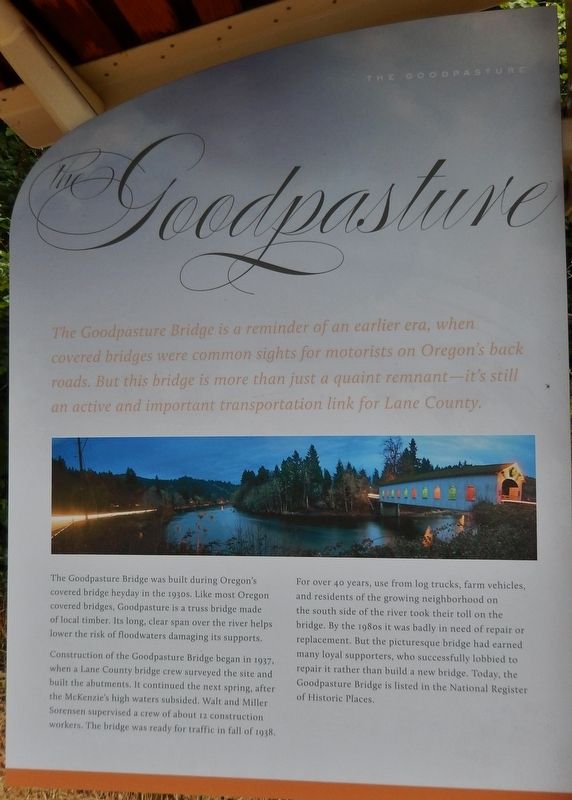
On Goodpasture Road east of McKenzie Highway (Oregon Route 126), on the right when traveling west.
(panel 1) The Goodpasture Bridge is a reminder of an earlier era, when covered bridges were common sights for motorists on Oregon’s back roads. But this bridge is more than just a quaint remnant — it’s still an . . . — — Map (db m113714) HM
On S Pioneer St, on the right when traveling south.
Powerful floods, heavy traffic loads, vandalism, and neglect have led to the demise of hundreds of historic covered bridges. As vehicles and logging trucks got bigger, covered bridges, such as this one, were built with wider and higher portals. . . . — — Map (db m112919) HM
Site of the home of A. W. and Amanda Patterson. He was a pioneer Lane County doctor and surveyor who plotted a greater part of Eugene. In 1853, Patterson was also a member of the Oregon legislature and was instrumental in establishing the University . . . — — Map (db m112888) HM
On East 11th Avenue at Alder Street, on the right when traveling west on East 11th Avenue.
Site of the home of A.W. and Amanda Patterson. He was a pioneer Lane County doctor and surveyor who plotted a greater part of Eugene. In 1853, Patterson was also a member of the Oregon Legislature and was instrumental in establishing the University . . . — — Map (db m99248) HM
On Oregon Route 58 south of Edenvale Road, on the left when traveling north.
In 1845 Elijah Bristow and his wife (Susannah Gabbart Bristow) left their home in Illinois and traveled overland to California. They came to Oregon in the spring of 1846, following the Hudson's Bay trappers' route to the northern Willamette Valley. . . . — — Map (db m99220) HM
At the turn of the 20th century, wagonloads of settlers and supplies traveling along the old Oregon Central Military Wagon Road stopped here to board Amos D. Hyland's ferry to cross the Willamette River. As more and more settlers traveled the route, . . . — — Map (db m112920) HM
On Cheshire Ave at N Lincoln St, on the right when traveling west on Cheshire Ave.
(The following two of four interpretive displays located in this park highlight the Applegate Trail):
(First Display)
In 1846, Jesse Applegate and fourteen others from near Dallas, Oregon, established a trail south from the . . . — — Map (db m116803) HM
Inspired by his own childhood experiences, author Stephen King wrote the novella, "The Body," in 1974. It was later turned into the coming-of-age movie,
"Stand by Me," partially filmed here in Brownsville. Directed by Rob Reiner, the film . . . — — Map (db m302951) HM
On North River Road near West Main Street, on the right when traveling north.
The trail to Oregon was never a single set of wagon ruts etched from Missouri to the Willamette Valley. Wagons often traveled abreast through valleys and plains sometimes widening the trail several miles. In the mountains they constantly attempted . . . — — Map (db m112912) HM
On Skinner Butte Loop, on the left when traveling north. Reported missing.
Early settler of this region for whom the city of Eugene and Skinner Butte is named. According to tradition, Skinner built the area’s first cabin near this site, ca 1846. — — Map (db m264844) HM
On Territorial Hwy, on the left when traveling north.
This marks the Old Stage Route and the Daniel Smith Donation Land Claim Homesite 1852 – 1908 Smithfield Dedicated in His Honor 1862 — — Map (db m117049) HM
Thin black lines indicate changes in relevance. Between each pair of lines entries are ordered geographically but all have the same relevance.
* Inflectional forms of words are their plurals, singulars, and possessives as well as gramatical tenses and similar variations.