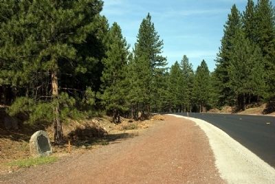
Through this draw passed many covered wagons and gold seekers enroute to California over the Lassen Trail during 1848-1851. Approaching this location from the north, the trail passed what is now Bogard Ranger Station. Proceeding southward to Big . . . — — Map (db m22027) HM
On State Highway 395, on the left when traveling south.
This route was first used in 1852 by emigrants to Northern California seeking to avoid the hardships of the Lassen Trail. It crossed the desert from the Humbolt River in Nevada, passed this point, and proceeded over the mountains to the town of . . . — — Map (db m10269) HM
Peter Lassen opened the Lassen Emigrant Trail in 1848 when he led a 12-wagon emigrant train from Missouri to California. The route, which passed near this place, was extensively traveled during the years 1848-53 by emigrants seeking gold, adventure, . . . — — Map (db m10264) HM
Near North Street, on the right when traveling north.
This meadow, now a city park, was a welcome stopping place on the Noble Emigrant Trail, pioneered by William H. Nobles in 1851 and first used in 1852. Here, emigrants en route to the Northern California mines were able to rest, refresh their stocks, . . . — — Map (db m10268) HM
Near Bucks Lake Road (County Route 119) at Snake Lake Road, on the left when traveling east.
Millions in gold were taken from the Spanish Creek Mines between 1851 and 1905. To supply the miners the small town of New Boston sprang up at the mouth of Wahponsey Creek. Complete with a toll gate, apple orchard and gardens, in the 1870’s it was . . . — — Map (db m56530) HM
On State Highway 99 1 mile north of South Avenue when traveling south.
This monument was erected on the 75th anniversary of the date of its charter May 10th 1923 by Western Star Lodge No. 2 F.& A.M. of Shasta, Calif.
The oldest Masonic Chapter in Calif.
Granted May 10th 1848 by the Grand Lodge of Missouri
to . . . — — Map (db m113893) HM
On North Valley Road, on the left when traveling east.
Site of Trading Post - 1851
Dedicated by Plumas Pioneer Parlor No. 210, N.D.G.W.
Plumas Parlor No. 228, N.S.G.W.
October 26, 1930
Peter Lassen Marker
Historical Landmark No. 184
State of California — — Map (db m143425) HM
Thin black lines indicate changes in relevance. Between each pair of lines entries are ordered geographically but all have the same relevance.
* Inflectional forms of words are their plurals, singulars, and possessives as well as gramatical tenses and similar variations.