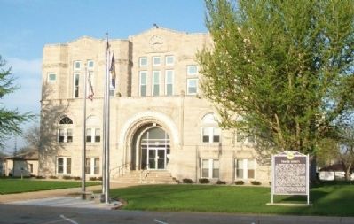
On 4th Street north of Olive Avenue, on the left when traveling north.
The boundaries of the future Thayer County were first defined in 1856, and the county was named Jefferson. In 1867 Jones County to the east was attached. The legislature in 1871 divided the single large county into two, naming the western county . . . — — Map (db m79885) HM
On 9th Street just west of C Street, on the right when traveling west.
During the nineteenth century the United States underwent a dramatic westward expansion, but perhaps no single event stimulated this mass migration more than the 1848 discovery of gold at Sutter’s Mill in California. Hundreds of thousands of . . . — — Map (db m206659) HM
On State Highway 4 6.8 miles east of U.S. 81, on the left when traveling east.
Bruning Army Air Field, located northeast of here, was one of eleven army airfields in Nebraska during World War II. Construction began in September 1942 on 1,480 acres of farmland, for which the government paid twelve landowners $73,400. The field . . . — — Map (db m206989) HM
Thin black lines indicate changes in relevance. Between each pair of lines entries are ordered geographically but all have the same relevance.
* Inflectional forms of words are their plurals, singulars, and possessives as well as gramatical tenses and similar variations.