Near Toburn Road, 0.2 kilometers west of Government Road East (Trans-Canada Highway) (Provincial Highway 66), on the left when traveling west.
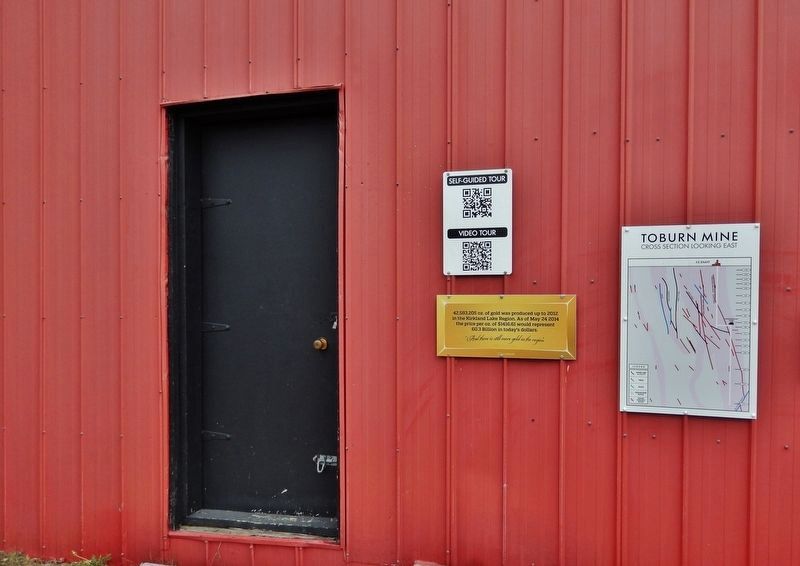
42,583,205 oz. of gold was produced up to 2012 in the Kirkland Lake Region. As of May 24 2014 the price per oz. of $1416.61 would represent 60.3 Billion in today's dollars. “And there is still more gold in the region” — — Map (db m244799) HM
Near Toburn Road, 0.2 kilometers west of Government Road East (Trans-Canada Highway) (Provincial Highway 66), on the left when traveling west.
[English]This monument commemorates the prospectors of the Kirkland Lake Gold Camp, whose discoveries led to the incorporation of Kirkland Lake (Teck) in January 1919. Dedicated on June 29, 2019, in honour of the Kirkland Lake . . . — — Map (db m244878) HM
Near Toburn Road, 0.2 kilometers west of Government Road East (Trans-Canada Highway) (Provincial Highway 66), on the left when traveling west.
[English] These small motors enabled trains of cars to be hauled to the dump points together instead of being pulled or pushed one at a time by a miner. The batteries were lead/acid and required charging up every day at underground . . . — — Map (db m244798) HM
Near Toburn Road, 0.2 kilometers west of Government Road East (Trans-Canada Highway) (Provincial Highway 66), on the left when traveling west.
[English] The cage is used to convey men and equipment up and down the shaft. It is also used to haul ore to surface for processing in the mill. Note the tracks in the floor which allowed ore cars to be rolled in and out of the . . . — — Map (db m244884) HM
Near Toburn Road, 0.2 kilometers west of Government Road East (Trans-Canada Highway) (Provincial Highway 66), on the left when traveling west.
Boyles Brothers BBU-1 Underground Diamond Drill • Powered by compressed air – V twin motor • Easily disassembled for transport to confined underground locations • Capacity of 300 m using “A” size rods • Often drilled multiple holes from one . . . — — Map (db m244891) HM
Near Toburn Road, 0.2 kilometers west of Government Road East (Trans-Canada Highway) (Provincial Highway 66), on the left when traveling west.
[English] These small ore cars could be pushed by hand (hand tramming) or hauled by an electric locomotive along an underground railway system. The cars could be loaded by hand (shovel), by a mucking machine, or by opening a chute . . . — — Map (db m244895) HM
Near Toburn Road, 0.2 kilometers west of Government Road East (Trans-Canada Highway) (Provincial Highway 66), on the left when traveling west.
[English] Accidental fires were frequent in pioneer days. One of the first structures built at a mine site would be the water tower. Usually built on an elevated site, it would provide enough pressure to supply hoses connected to . . . — — Map (db m244896) HM
Near Toburn Road, 0.2 kilometers west of Government Road East (Trans-Canada Highway) (Provincial Highway 66), on the left when traveling west.
[English] The mine hoist is a large winch that raises and lowers the two cages from surface to the underground workings. The hoist operator communicated with the underground stations at each level via signals such as: 1 Bell = . . . — — Map (db m244897) HM
Near Toburn Road, 0.2 kilometers west of Government Road East (Trans-Canada Highway) (Provincial Highway 66), on the left when traveling west.
[English] The sinking bucket was initially used to mine the vertical openings or SHAFTS that were used to access the ore bodies at depth. The buckets were used to hoist the waste rock after it had been blasted and to hoist the water . . . — — Map (db m244898) HM
Near Toburn Road, 0.2 kilometers west of Government Road East (Trans-Canada Highway) (Provincial Highway 66), on the left when traveling west.
[English] This winch could be powered by steam or compressed air. It is small enough to be hauled into place by a team of horses. To sink a small shaft, a large tripod would be set up over the hole and a sinking bucket be used to . . . — — Map (db m244899) HM