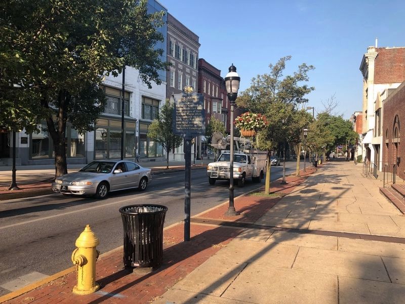
This list shows various locations of Wayne's March in that started in York, Pennsylvania into Virginia to meet up with General Lafayette in the actions leading to the British surrender at the Battle of Yorktown.
On West Market Street (Pennsylvania Route 462) at Beaver Street, on the left when traveling east on West Market Street.
Building erected in Colonial Period was headquarters of Gen. Anthony Wayne while his command was in York, Feb. - May, 1781, awaiting orders to join Lafayette in the Yorktown Campaign. — — Map (db m303342) HM
On North Beaver Street just north of West Market Street ( Route 462), on the left when traveling north.
▲ On this site ▲
General Anthony Wayne
in the Spring of 1781,
established headquarters of
The Pennsylvania Line
and recruited for the campaign
which ended in the surrender of
Lord . . . — — Map (db m303343) HM
On South Queen Street at East King Street, on the right when traveling north on South Queen Street.
Littlestown is situated at the intersection of the Old Monocacy Road (opened in 1736) and the Baltimore to Pittsburgh Road, (1770) later known as the Gettysburg and Petersburg Turnpike. The Old Monocacy Road was the road between Wrightsville, PA . . . — — Map (db m303344) HM
On Francis Scott Key Highway (Route 194) 0.3 miles north of Bruceville Road, on the right when traveling south.
On May 28, 1781, General Anthony Wayne and 800 Continental soldiers camped along the banks of Big Pipe Creek on the Old Monocacy Road on their way from York, Pennsylvania to join General Lafayette in Virginia. Their combined forces hampered . . . — — Map (db m303339) HM
On Monocacy Boulevard south of Laurel Wood Way, on the right when traveling south.
"Where this letter will meet you, I am not able to ascertain, But ardently wish it May Be Near this place where your presence is absolutely necessary."
Lafayette letter to Anthony Wayne, May 15, 1781, near Richmond, . . . — — Map (db m303341) HM
On James Monroe Highway (U.S. 15) 0.2 miles south of Stumptown Road and Lucketts Road, on the left when traveling south. Reported permanently removed.
Three miles southeast, at Noland’s Ferry, “Mad Anthony” Wayne, on his way to join Lafayette, crossed the Potomac River, May 31, 1781. He passed through Leesburg June 3, and joined Lafayette near the Rapidan River, June 18. — — Map (db m248172) HM
On Louisa Road (Virginia Route 22) 0.2 miles east of Cobham Station Lane ( Route 640), on the right when traveling north. Reported missing.
After reinforcements from Brig. Gen. "Mad" Anthony Wayne arrived on 10 June 1781, the Marquis de Lafayette moved south from his camp on the Rapidan River to prevent further raids by Gen. Charles Cornwallis's British troops encamped at Elk Hill. . . . — — Map (db m303345) HM
On Monocacy Boulevard south of Laurel Wood Way, on the right when traveling south.
"Where this letter will meet you, I am not able to ascertain, But ardently wish it May Be Near this place where your presence is absolutely necessary."
Lafayette letter to Anthony Wayne, May 15, 1781, near Richmond, . . . — — Map (db m303341) HM
On James Monroe Highway (U.S. 15) 0.2 miles Spinks Ferry Road, on the right when traveling north.
On 26 May 1781, Brig. Gen. Anthony Wayne began moving south from PA to reinforce the Marquis de Lafayette, who was maneuvering against British Lt. Gen. Charles Cornwallis in VA. Wayne's troops, including three infantry battalions of the PA line . . . — — Map (db m303340) HM
On Raccoon Ford Road (Virginia Route 617) 0.5 miles south of Algonquin Trail ( Route 647), on the left when traveling south.
... Thence to Raccoon Ford on the Rapidan where we joined General Wayne's Forces.
Darius O'Neil was born in 1764, and was a resident of Culpeper, Virginia.
On June 10, 1781, 800 Pennsylvania Continental soldiers, led by "Mad" Anthony . . . — — Map (db m303346) HM