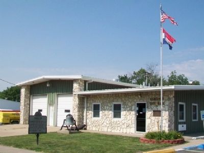
On Davis Street (Missouri Route 13) south of School Street, on the right when traveling south.
Founded in 1855 and named for Alexander Hamilton and Joseph Hamilton. First incorporated in 1868. Ten miles southwest the Mormons in 1836 established the town of Far West, the county seat from 1836 to 1843. — — Map (db m66996) HM
A native of England, he came to New Brunswick in 1812 and then into the U.S., first settling in Kentucky. As a Mormon living in Missouri in 1838, he was sent as an emissary to negotiate with an army that was either going to kill all Mormons or move . . . — — Map (db m154510) HM
On East Main Street just east of North Washington Street ( Highway 13).
The fertile Shoal Creek Valley, Kingston was laid out in 1843 to replace Far West as seat of Caldwell County. Organized in 1836, the county was to be for Latter Day Saints (Mormons), ejected from Jackson County in 1833 and asked to leave Clay . . . — — Map (db m144715) HM
On NE Hauns Mill Drive 0.5 miles west of Catawba Road, on the left when traveling west. Reported missing.
In December 1835, Church member Jacob Haun acquired this tract of land and hired the construction of a gristmill. By 1838 an 18-foot square blacksmith shop had also been built and 10 to 15 families lived in the community. Cultural differences . . . — — Map (db m153436) HM
On Southview Drive at Ruth Ewing Road, on the left when traveling south on Southview Drive.
In September of 1861, Liberty and Clay County briefly became a focal point during the American Civil War in Missouri. Near this site, the Battle of Liberty was a decisive victory achieved by the pro-Southern Missouri State Guard against Union . . . — — Map (db m245595) HM
On Verdi Road 1 mile west of Farm to Market Road 3006.
Thomas Ransdell Brite was born in 1824 in Callaway County, Missouri. His family moved to Bastrop County when he was 16. In 1842, when Mexican armies invaded Texas, Thomas volunteered to serve in the Vasquez, Woll and Somervell campaigns in the . . . — — Map (db m260134) HM
On Interstate 10 Frontage Road 0.2 miles north of Spanish Pass Road, on the right when traveling north.
Called "The Fighting Parson," Andrew Jackson Potter is a well-known figure in 19th century Texas history. He was born in Chariton County, Missouri on April 3, 1830, to Joshua Potter (1776-1840) and Martha (Johnson) Potter (d. 1840). His mother . . . — — Map (db m292910) HM
On Davis Street (Missouri Route 13) at McGaughy Street, on the left when traveling north on Davis Street. Reported permanently removed.
J.C. Penney 1875-1971 • 500th J.C. Penney Store opened in 1924 • Frank Clark's Mill 1867 • Sam McBrayer's Livery Stable 1898 • Caldwell County Courthouse in Kingston Built 1898 • J.C. Penney Farms • Far West Memorial • Hamilton Holiday Street . . . — — Map (db m66988) HM
Thin black lines indicate changes in relevance. Between each pair of lines entries are ordered geographically but all have the same relevance.
* Inflectional forms of words are their plurals, singulars, and possessives as well as gramatical tenses and similar variations.