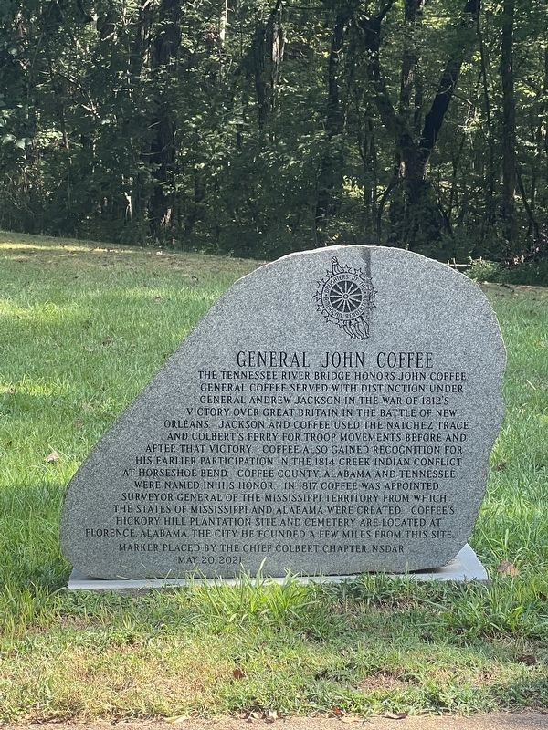
On Rock Spring 0.1 miles east of Natchez Trace Parkway.
The Tennessee River Bridge honors General John Coffee. General Coffee served with distinction under General Andrew Jackson in the War of 1812's victory over Great Britain in the Battle of New Orleans. Jackson and Coffee used the Natchez Trace and . . . — — Map (db m232314) HM
On 5th Avenue North, on the left when traveling north.
Eastern Highland Rim
The Eastern Highland Rims coupled with the Western Rim is the upland surrounding the Central Basin of Tennessee. It is separated from the Western Rim on the north by the passage of the Cumberland River into Tennessee . . . — — Map (db m206497) HM
Cheatham's small stone is about 100 feet back. Cheatham was born in Nashville. His mother's grandfather was James Robertson, the founder of Nashville. He grew up on the family plantation on the Cumberland River's Cockrell Bend. The Cheathams came . . . — — Map (db m166477) HM
Near NE Atlantic Street north of East Lincoln Street, on the left when traveling north.
Tullahoma, chartered in 1852, was laid out by a Town Company along the Nashville and Chattanooga Railroad line being built at the time. The street along the railroad was named “Atlantic” perhaps because the railroad made possible an . . . — — Map (db m172367) HM
The Civilian Conservation Corps was launched by President Franklin D. Roosevelt April 5, 1933 as a lifeline for undernourished sons of the Great Depression. Each company consisted of about 200 men who were housed in Tennessee barracks under the . . . — — Map (db m81376) HM
On North Spring Street at West Main Street, on the left when traveling north on North Spring Street.
After the Battle of Stones River on January 2, 1863, Union Gen. William S. Rosecrans occupied Murfreesboro. Confederate Gen. Braxton Bragg withdrew south to the Highland Rim to protect the rail junction at Tullahoma, Bragg's headquarters, . . . — — Map (db m156117) HM
On Hillsboro Highway (U.S. 41) at Tyree Cove Road, on the right when traveling south on Hillsboro Highway.
Coffee County
Established 1836; named in honor of
Major General John Coffee
soldier, surveyor, and close friend of Andrew Jackson. Tennessee troops under his command took a decisive part in the New Orleans Campaign, December 23, 1814 to . . . — — Map (db m150467) HM
On South Jackson Street (State Highway 41-a) at Vocational Lane, on the left when traveling south on South Jackson Street.
Coffee County
Established 1836; named in honor of
Major General John Coffee
Soldier, surveyor and close friend of Andrew Jackson. Tennessee troops under his command took a decisive part in the New Orleans Campaign, December 23, 1814 to . . . — — Map (db m81380) HM
Thin black lines indicate changes in relevance. Between each pair of lines entries are ordered geographically but all have the same relevance.
* Inflectional forms of words are their plurals, singulars, and possessives as well as gramatical tenses and similar variations.