Near South 8th Avenue West 0.2 miles south of Voyageur Highway (State Highway 61), on the left when traveling south.
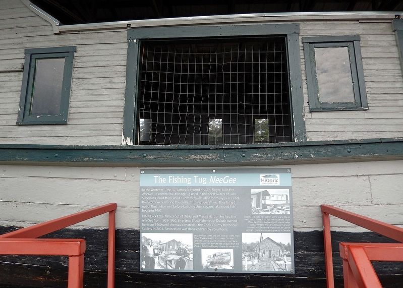
In the winter of 1936-37, James Scott and his son, Roger, built the NeeGee — a commercial fishing tug used in the deep waters of Lake Superior. Grand Marais had a commercial harbor for many years, and the Scotts were among the earliest . . . — — Map (db m267412) HM
When Newton H. Winchell, Minnesota's state geologist, and, Ulysses S. Grant II (the president’s son) surveyed this area in the 1890s, they concluded that a peak in the Misquah Hills was the state's highest point. Using an aneroid barometer, . . . — — Map (db m151362) HM
Near South 8th Avenue West 0.2 miles south of Voyageur Highway (State Highway 61), on the left when traveling south.
Or “Friend” in Ojibwe, was built at Grand Marais in 1936 by the Scott Family. While other fishing tugs fished from this harbor, only the Neegee was built here. A typical Lake Superior fishing tug, the Neegee was intended to fish off shore. In the . . . — — Map (db m267430) HM
Near South 8th Avenue West 0.2 miles south of Voyageur Highway (State Highway 61), on the left when traveling south.
Built in the 1940s in Colvill, Minnesota by John and Randolph Samskar and donated to the Cook County Historical Society by the Randolph Samskar Estate. A number of fishermen along the North Shore had similar, but often smaller, smokehouses. Most . . . — — Map (db m267435) HM
Near South 8th Avenue West 0.2 miles south of Voyageur Highway (State Highway 61), on the left when traveling south.
Native peoples harvested Lake Superior fish for thousands of years prior to 1835, when John Jacob Astor's American Fur Company established a commercial fishing post in Grand Marais. The company employed these same Native peoples, as well as former . . . — — Map (db m267409) HM
Near Congdon Boulevard (North Shore Drive) (State Highway 61) at McQuade Road, on the left when traveling north.
U.S. Highway 61 from Duluth to the Canadian border was built in the 1920s and 1930s. Originating in historic Indian trails and military roads of the late 1800s, the paved route was proudly named the Lake Superior International Highway. Visitors . . . — — Map (db m266791) HM
On State Highway 61 at milepost 117, 1.3 miles north of County Highway 14, on the right when traveling north.
In 1906 this community was named in honor of Colonel William Colvill, commander of the First Minnesota Regiment.
At the Battle of Gettysburg, July 2, 1863, this regiment was ordered to charge and advance of Confederates twenty times their . . . — — Map (db m232203) HM