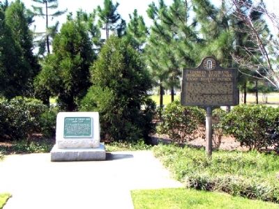
On Clay Pit Road 0.1 miles south of Georgia Veterans Road, on the right when traveling south.
Here begins “Georgia Veterans Memorial State Park.” This 1,200 acre tract of land was purchased by Crisp County Commissioners and given to the State of Georgia December 4, 1946 in grateful appreciation of, and as a living memorial to the . . . — — Map (db m35041) HM
Near Wall Street West west of 7th Street North (U.S. 41), on the right when traveling west.
In November 1864 Milledgeville was the capital of Georgia. General William Sherman and his men were drawing near as they marched through the State. With the legislature in session, Governor Joseph E. Brown was doing all he could to pack the state . . . — — Map (db m174321) HM
On South 7th Street (U.S. 41) 0 miles north of 13th Avenue West, on the left when traveling north.
Crisp County was created by Act of Aug. 17, 1905 from Dooly County. It was named for Charles Frederick Crisp (1845-1896), Georgia lawyer, judge, Congressman, who was born in Sheffield, England, of actor parents touring the British Isles. Judge Crisp . . . — — Map (db m53210) HM
On U.S. 280 at Cannon Road, on the left when traveling west on U.S. 280.
This 1000 acre tract, once the hunting and fishing grounds of Creek Indians, was purchased from Dr. Russell Thomas and John F. Thomas on December 4, 1946, by the Crisp County Commissioners, Dr. L.E. Williams, J. Homer Dorough and Claude L. McMillan, . . . — — Map (db m113889) HM WM
Thin black lines indicate changes in relevance. Between each pair of lines entries are ordered geographically but all have the same relevance.
* Inflectional forms of words are their plurals, singulars, and possessives as well as gramatical tenses and similar variations.