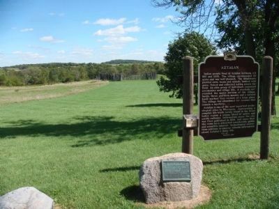
On County Road Q 0.3 miles south of County Road B, on the left when traveling south.
Site of the famous prehistoric Indian stockade-protected village known as Aztalan first described by N.F. Hyer in the Milwaukee Advertiser in January 1837. Described by Dr. Increase A. Lapham, in The Antiquities of Wisconsin in 1855. . . . — — Map (db m35296) HM
On Hill Street west of Chapel Ridge Road, on the right when traveling west.
In the spring of 1841, Gustaf Unonius, his wife Charlotta, and several companions set out from Upsala, Sweden, for what was then the northwest frontier of the United States. Inspired by Swedish Romanticism, Gustaf pursued the dream of a life in a . . . — — Map (db m254352) HM
On Wells St 0.2 miles west of Genessee St (Cnty Rd C), on the left when traveling west.
Built in 1846 of hand-hewn timbers and hand-made nails. Builder & owner was Nelson Paige Hawks (1799-1863), a cultured Yankee, who was Delafield’s first Postmaster, a Justice of the Peace, Town Chairman, owner of a grist & saw mill, & builder of . . . — — Map (db m43597) HM
On Concord Center Drive (County Highway B) 0.1 miles west of Grey Fox Trail, on the right when traveling west.
The Wm. R. Look Log Cabin is an example of pioneer architecture in southeastern Wisconsin. This historic log home was originally located on Pioneer and Elder Roads in the Town of Concord. Over the years the log cabin was covered in clapboard and an . . . — — Map (db m37007) HM
Near County Road Q south of County Road B, on the left when traveling south.
The first dairy co-op in Wisconsin founded in Jefferson County 1841-1845 by Anne Pickett (1804-1884) a resident of the Aztalan-Lake Mills area in her log house kitchen from milk obtained from a 20 cow herd plus 10 rented cows on a contract calling . . . — — Map (db m176788) HM
On Koshkonong Mounds Road 1 mile west of Old Wisconsin Highway 26.
Between AD 650 and 1200, groups of Native Americans throughout the southern half of Wisconsin and portions of adjacent states built earthen mounds of various shapes and sizes, including mounds shaped like animals, today called effigy mounds. The 11 . . . — — Map (db m31766) HM
On Storrs Lake Road at South Janesville Street (Wisconsin Highway 26 / 59), on the left when traveling east on Storrs Lake Road.
On July 1, 1832, here beside Storrs Lake, Brigadier General Henry Atkinson and 4,500 soldiers camped overnight in their pursuit of Black Hawk, Sac Indian chief, who was fleeing northward up the east side of Rock River with 400 warriors and 1200 . . . — — Map (db m22727) HM
Near Hardesty Avenue north of 63rd Street, on the left when traveling north.
In the frosty darkness of the early pre-dawn hours of October 22, 1864, 300 citizen soldiers of the 4th Kansas State Militia crossed over Byram's Ford here. They encamped on the west side in a nearby cornfield on the opposite high bank. The . . . — — Map (db m187215) HM
Thin black lines indicate changes in relevance. Between each pair of lines entries are ordered geographically but all have the same relevance.
* Inflectional forms of words are their plurals, singulars, and possessives as well as gramatical tenses and similar variations.