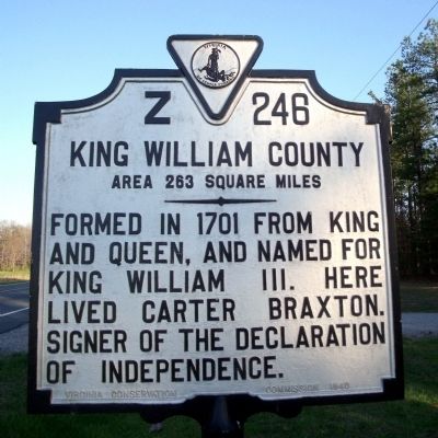
On Dawn Boulevard (Virginia Route 30) 0.8 miles west of Calno Road, on the right when traveling east.
Caroline County. Area 529 Square Miles. Formed in 1727 from Essex, King and Queen, and King William. Named for Queen Caroline, wife of King George II. George Rogers Clark, conqueror of the Northwest, passed his youth in this . . . — — Map (db m17789) HM
On King William Road (Virginia Route 30) east of Indian Church Road, on the left when traveling east.
The Sharon Indian School has played an integral role in shaping the identity of the Upper Mattaponi Tribe for over a century. The original structure was built in 1919 as a one room schoolhouse by the hands of our ancestors. Due to . . . — — Map (db m309536) HM
On Krause Road at Iron Bridge Road ( Route 10), on the right when traveling north on Krause Road.
Before the start of the American Revolution, free Black men were enrolled in local county militias across Virginia. When the war began, these men often volunteered to enlist in Virginia's Continental battalions. Hundreds of Black patriots, including . . . — — Map (db m289579) HM
On King William Road (Virginia Route 30) west of Cuz Way, on the right when traveling west.
Sharon Indian School served as a center of education for the Upper Mattaponi Tribe. Tribal citizens built and furnished a one-room frame building ca. 1919. King William County replaced the original school with this brick structure in 1952. Before . . . — — Map (db m309534) HM
On King William Road (Virginia Route 30) 0.1 miles east of Indian Church Road ( Route 658), on the left when traveling east. Reported permanently removed.
Sharon Indian School served as a center of education for the Upper Mattaponi Tribe. In 1919, the King William County School Board built a one-room frame building and the students' families provided the furniture. The county replaced the original . . . — — Map (db m25839) HM
Near Horse Landing Road (Virginia Route 619) just north of Courthouse Road ( Route 1301), on the right when traveling north.
In memory of Henry Jenner Jones born in King William County, Virginia on March 10, 1847, a VMI cadet, Private D Company, killed in the Battle of New Market on May 15, 1864. — — Map (db m175970) WM
On Courthouse Road (Virginia Route 1301) at Horse Landing Road ( Route 619), on the right when traveling west on Courthouse Road.
The King William County courthouse, erected early in the second quarter of the 18th century, is one of the older courthouses still in use in the United States. This T-shaped building was constructed of brick laid in Flemish bond, with an arcade . . . — — Map (db m25847) HM
Near Courtland Farm Road (Virginia Route 820) 0.2 miles east of Hanover Courthouse Road (U.S. 301), on the right when traveling east.
(side 1)
The Colonial River Road
After centuries of use by native people and the colonists of New Kent County, the road along the Pamunkey River was extended past the tobacco ports of Newcastle and Page’s Warehouse (later . . . — — Map (db m53801) HM
On North Carolina Road (Virginia Route 604) at Richmond-Tappahannock Highway (U.S. 360), on the left when traveling south on North Carolina Road.
James L. Townsend Sr. was a pioneer in the dairy industry in King William County, Virginia. His son, Guy O. Townsend built the barn which has been a landmark on the Richmond-Tappahannock Highway for almost 90 years. A later addition at the end of . . . — — Map (db m103585) HM
Spotsylvania County. Straddling the fall line, Spotsylvania County was formed from Essex, King William, and King and Queen Counties in 1720. It was named for Alexander Spotswood, lieutenant governor of Virginia from 1710 to 1722. The Civil War . . . — — Map (db m3319) HM
On South Main Street (U.S. 301) at Greensville Avenue, on the right when traveling south on South Main Street. Reported permanently removed.
William McKendree was born in King William County in 1757. He soon moved with his family to present-day Greensville County, and later served in the Revolutionary War. In 1786, the county licensed him to keep a tavern at his house (12 miles . . . — — Map (db m18943) HM
On South Broadway (State Highway 109) at West Longview Drive, on the right when traveling south on South Broadway.
One and eight-tenths miles west of here was
the home of Bishop William McKendree, who
was born in King William County, Virginia.
During the American Revolution. he served
as Adjutant in the commissary department
supplying the armies of . . . — — Map (db m148018) HM
Near Constitution Avenue Northwest (U.S. 50) east of 19th Street Northwest, on the right when traveling east.
In Congress, July 4, 1776.Unanimous Declaration of the thirteen united States of America.And for the support of this Declaration,
with a firm reliance on the protection of Divine Providence,
we . . . — — Map (db m137039) HM
Thin black lines indicate changes in relevance. Between each pair of lines entries are ordered geographically but all have the same relevance.
* Inflectional forms of words are their plurals, singulars, and possessives as well as gramatical tenses and similar variations.