On Market Street (U.S. 63) north of 1st Avenue, on the right when traveling north.
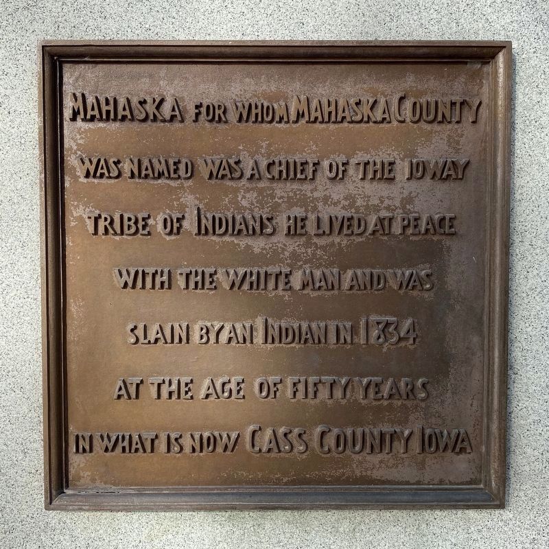
Mahaska for whom Mahaska County was named was a chief of the Ioway Tribe of Indians he lived at peace with the white man and was slain by an Indian in 1834 at the age of fifty years in what is now Cass County Iowa
The Ioways a powerful tribe . . . — — Map (db m236011) HM
Near Interstate 35 south of Iowa Highway 34, on the right when traveling south.
The Mormon Trail The Mormons of Nauvoo, Illinois, forced from their homes following the murder of their prophet, Joseph Smith, Jr., began their trek across Iowa in 1846 on the way to the Great Salt Lake Valley. From their first permanent . . . — — Map (db m237260) HM
Near Interstate 35 north of County Highway J52, on the right when traveling north.
The Mormon Trail The Mormons of Nauvoo, Illinois, forced from their homes following the murder of their prophet, Joseph Smith, Jr., began their trek across Iowa in 1846 on the way to the Great Salt Lake Valley. From their first permanent . . . — — Map (db m224588) HM
On High Avenue East at North 1st Street, on the right when traveling west on High Avenue East.
Look to the top. What do you see? IMB Soc. stands for the Iowa Masons' Benevolent Society.
This was an Oskaloosa based life insurance company organized in 1876. It targeted the Masonic fraternal community as a group. In those days, . . . — — Map (db m236346) HM
On High Avenue West at Market Street (U.S. 63), on the right when traveling west on High Avenue West.
• The Mahaska County Courthouse was erected on this site in 1845. The building was a two story wooden structure and was used not only as a courthouse but also for all manner of "frontier frolics" including church services, operas, and in 1849 a . . . — — Map (db m236335) HM
On State Highway 92 at Newport Avenue, on the right when traveling east on State Highway 92.
“The Rock” The Mahaska County Freedom Rock is a permanent memorial honoring all past, present, and future veterans of Mahaska County. The project was initiated in 2014 by the Harry L. Anderson Unit #34 American Legion Auxiliary. The project . . . — — Map (db m292200) HM
Thin black lines indicate changes in relevance. Between each pair of lines entries are ordered geographically but all have the same relevance.
* Inflectional forms of words are their plurals, singulars, and possessives as well as gramatical tenses and similar variations.