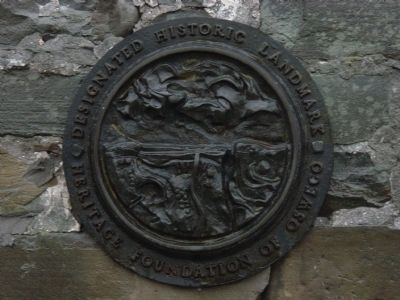
Selkirk Lighthouse has been placed on the National Register Of Historic Places
By the United States Department of the Interior
Built 1838 — — Map (db m51909) HM
On Charles Street at Sumans Avenue, on the left when traveling west on Charles Street.
The Robert Moxley Band was a group of African-American musicians, mostly local slaves, who formed a military-style brass band in the years before the Civil War. The band held regular concerts in what is now Jacob Wheaton Park. In 1863 the U.S. . . . — — Map (db m107363) HM
On East 1st Street (New York State Route 481) north of East Mohawk Street, on the right when traveling south.
The thriving port city of Oswego was founded by and attracted many ambitious and heroic people. Leaders of industry and social causes lived here and left their mark on the city. You can still visit some of their works by touring the city streets . . . — — Map (db m86292) HM
On George Street (New York State Route 49) south of Frederick Street, on the right when traveling west.
This Property Has Been
Placed On The
National Register
Of Historic Places
By The United States
Department Of The Interior
Circa 1831 — — Map (db m308850) HM
Near NY Thruway (Interstate 90), on the right when traveling west.
Numbers Tell the Tale
The Erie Canal originally spanned 363 miles and was 40 feet wide and 4 feet deep. It was largely
built by farmers and finished by immigrants, with not a single trained engineer among them and
without any mechanized . . . — — Map (db m133734) HM
On East 1st Street (New York State Route 481) south of East Oneida Street, on the left when traveling south.
Text on the east side of marker:
The O & W Railroad Promenade and Bikeway was constructed in 2000-2001 and is named for the New York, Ontario and Western Railroad which served Oswego from 1880 to 1957. The O & W, as it came to be known, . . . — — Map (db m86610) HM
Crossroads Timeline
1976 Blockhouse Museum Opened
1927 Fort Designated a National Historic Landmark
1900
1871 Syracuse Northern Railroad reached Brewerton
1846 Plank Road Built From Salina to Central Square
Four Steamboats built: . . . — — Map (db m253242) HM
On Jefferson Street (U.S. 11) at Bridge Street, on the right when traveling south on Jefferson Street.
Pulaski Historic District
From Drill Field to Village Core
Village Timeline
2000 Log Cabin Motel burned in area of first log cabin.
1983 Historic District formed.
1887 First Long Bridge erected.
1882-1901 Eighteen of the 23 . . . — — Map (db m109092) HM
On East Oneida Street (New York State Route 104) at East 3rd Street, on the right when traveling east on East Oneida Street.
In Honor Of The
Soldiers And Sailors
Of The County Of
Oswego
Who Nobly Defended
The Union
1861- 1885
West Side:
24th N.Y. Infantry
May 17 1861- May 29,1863
Col. Timothy Sullivan
John D. O’Brian, Oswego, Capt. Co. A . . . — — Map (db m282566) HM WM
On West 18th Street at Baynard Boulevard on West 18th Street.
African American Medal of Honor Recipients Memorial
The Medal of Honor takes its place in our country as the highest award for military valor. The honor, awarded by the President in the name of Congress, may only be accorded an . . . — — Map (db m173924) HM WM
Thin black lines indicate changes in relevance. Between each pair of lines entries are ordered geographically but all have the same relevance.
* Inflectional forms of words are their plurals, singulars, and possessives as well as gramatical tenses and similar variations.