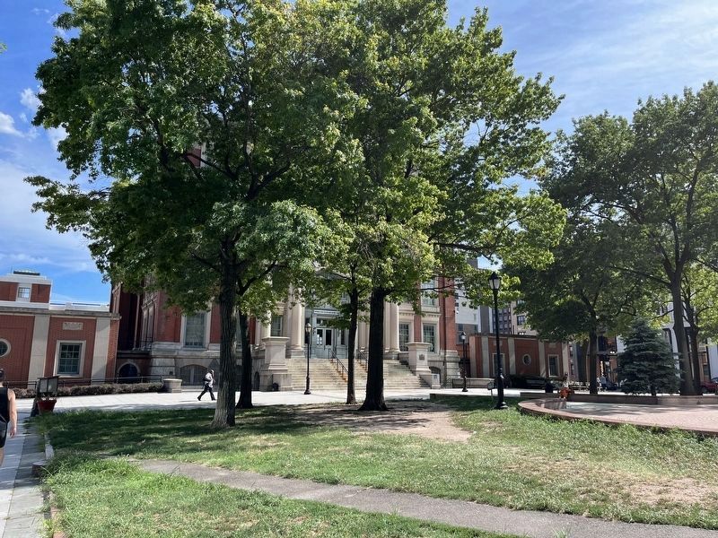
On Jackson Avenue (New York State Route 25A) at Thomson Avenue, on the left when traveling west on Jackson Avenue.
Originally built between 1872 and 1876, this courthouse was destroyed by fire and reconstructed in 1904-08. Redesigned by architect, Peter M. Coco, the English Renaissance-style building stands as a monument to the years when Long Island City served . . . — — Map (db m203807) HM
On W Main Street, on the right when traveling west.
General George Washington created a domestic network of spies, appointing Major Benjamin Tallmadge of Setauket as the head of the Long Island based Culper Spy Ring. Tallmadge appealed to Robert Townsend, a Manhattan merchant, to join him as a spy . . . — — Map (db m42812) HM
On Main Street at 75th Road, on the right when traveling south on Main Street.
Freedom Square is located in the heart of the Kew Gardens Hills neighborhood. As late as the 20th century this central Queens community was predominantly farmland, but the transportation improvements of the 1930s—Grand Central Park way and the . . . — — Map (db m271266) HM
On Kew Gardens Road at Lefferts Boulevard, on the right when traveling north on Kew Gardens Road.
The older section, Monumental Park was established in 1875 in the rural cemetery style. James E. Ware designed the administration building, entrance gate, and receiving tomb in 1880. Memorial Park was designed by George McClure in the twentieth . . . — — Map (db m271269) HM
Near Front Street at Liberty Street, on the right when traveling west.
Buried here are the first families of Hempstead; the Martins, Hewletts, Seaburys, Clowes, Bedells, Carmans, Van Wycks, and Woods just to name a few. Their stories offer a glimpse of life, their religion, disease, and family during the last three . . . — — Map (db m288598) HM
On Hickory Fork Road at South Belroi Road, on the right when traveling west on Hickory Fork Road.
The Belroi Landscape
Francis Stubbs opened a store at this Hickory Fork Road intersection between 1811 and 1818. Later, a tavern was built across the street. Behind the business places, a simple house exhibited a style common throughout . . . — — Map (db m270883) HM
Near Courtland Farm Road (Virginia Route 820) 0.2 miles east of Hanover Courthouse Road (U.S. 301), on the right when traveling east.
(side 1)
The Colonial River Road
After centuries of use by native people and the colonists of New Kent County, the road along the Pamunkey River was extended past the tobacco ports of Newcastle and Page’s Warehouse (later . . . — — Map (db m53801) HM
On Main Street (Nova Scotia Route 3), on the right when traveling east.
Step Back in Time
Step back to the beginning of the seventeenth century. The Mi'Kmaq had given Liverpool the name 'Ogomkegea', meaning "place of departure." Descending the Mersey River in the spring they would disperse along the coast . . . — — Map (db m112387) HM
On Broadway Boulevard (New Brunswick Route 130) at Victoria Street, in the median on Broadway Boulevard.
Born and raised in Drummond NB, Ron Turcotte was going to be a lumberjack, but fate played a role when he took charge of the logging horses, where he learned his legendary horsemanship.
In Toronto, he worked for Windfields Farm then later for . . . — — Map (db m250902) HM
Thin black lines indicate changes in relevance. Between each pair of lines entries are ordered geographically but all have the same relevance.
* Inflectional forms of words are their plurals, singulars, and possessives as well as gramatical tenses and similar variations.