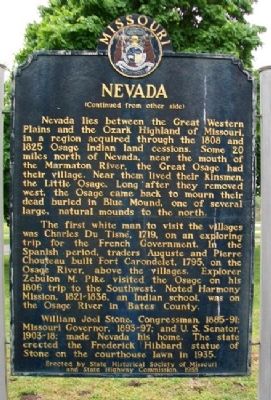
On Centennial Boulevard (U.S. 54) near Locust Street, on the right when traveling north.
Side A
Financial center and shipping point, this prairie town was founded in 1855 as the seat of Vernon County, fertile farming and coal producing area. Col. D. C. Hunter, who laid out the town, named it for Nevada City, Calif. The county, . . . — — Map (db m44016) HM
On Cherry Street near Main Street, on the right when traveling west.
Constructed in 1908
Placed on the National Register
of Historic Places
on this day June 27, 1997
by the United States
Department of Interior — — Map (db m34310) HM
On Main Street near Cherry Street, on the right when traveling north.
Nevada City was laid out as Vernon County's seat of government in 1855, and was named for a California town prominent during the Gold Rush. Founding spirit DeWitt C. Hunter had spent some years mining there before returning to western Missouri . . . — — Map (db m34210) HM
On Walnut Street (State Highway A) at 13th Street, on the right when traveling east on Walnut Street.
Historic Harmony Mission, a school for the Indians of Missouri, once stood east of Rich Hill, on the north bank of the Osage River, near the centuries-old camping sites of the Great and Little Osage tribes.
The mission was founded in 1821 by . . . — — Map (db m121349) HM
On West Ohio Street east of North Delaware Street, on the left when traveling west.
By 1863 the Union Army’s inability to control Confederate Guerrilla activity in western Missouri exploded. On August 25, 1863, Union General Thomas Ewing issued Order No. 11 four days after Quantrill’s Raid on Lawrence, Kansas. Residents in Bates . . . — — Map (db m74091) HM
On Lexington Street at Pearl Street, on the left when traveling north on Lexington Street.
(No inscription except for the title and portraits of significant personalities. This historical marker tells its story pictorially.)
[Portraits of]
Lewis Cass • L.O. Kunze
Henry & Bursheba Younger
[William] Quantrill • Cole Younger . . . — — Map (db m50871) HM
Near Farm Road 1080 south of U.S. 60, on the left when traveling north.
Native Americans have a long history in the Monett area. Artifacts from the
bottomland of the Monett golf course and the Long farm east of town
reflect centuries of occupation dating back to the Archaic Period 2,800 to
9,000 years ago, which is . . . — — Map (db m251440) HM
On Missouri Route 2 0.2 miles U.S. 71, on the left when traveling west.
The Civil War on the Missouri-Kansas border was an extension of the raiding and looting that took place during the Bleeding Kansas era of 1854 to 1860. Early in the war, Kansas Jayhawkers and Redlegs dressed in blue Union uniforms looted and . . . — — Map (db m20318) HM
On Paul Street at Broadway / Boardman St / Wyoming St, on the left when traveling west on Paul Street.
The American Civil War had a profound and long-lasting impact on the Pleasant Hill area. Its location in the border state of Missouri ensured that residents would align themselves on both sides of the conflict. Numerous skirmishes were fought . . . — — Map (db m88350) HM
On Thornton Street north of Main Street (State Highway 10), on the left when traveling north.
A lack of Confederate military presence in Missouri led Southern sympathizers to form guerrilla groups to harass Union soldiers and pro-Union citizens. Depending on which side you asked, these bushwhackers were either heroes or criminals. . . . — — Map (db m157096) HM
On Grand Avenue at Pine Street, on the left when traveling south on Grand Avenue.
This bell has been donated by the Rock School District of Cedar County Missouri in commemoration of the former Common School Districts which presently comprise the El Dorado Springs R-2 School District.
Cedar County
Barnes • Cedar Springs . . . — — Map (db m57417) HM
On Superior Street south of Broadway Road (State Highways 13, 16, and 23), on the left when traveling south.
A Wisconsin Pioneer
One of the founders of Wisconsin Dells, Joseph Bailey completed the first dam across the Wisconsin River here in 1859. Opposition from upriver lumbermen required the dam's removal in 1860. Bailey's dream to build an . . . — — Map (db m134610) HM
Thin black lines indicate changes in relevance. Between each pair of lines entries are ordered geographically but all have the same relevance.
* Inflectional forms of words are their plurals, singulars, and possessives as well as gramatical tenses and similar variations.